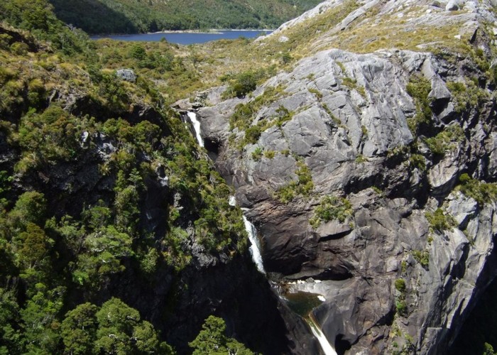
Boulder River waterfall North West Nelson

The photo shows just the top section of a large waterfall on the Boulder River. This waterfall is a short distance below the outlet of Boulder Lake which can be seen in the background.
A notable feature is that there are the remains of a weir at the top of the waterfall. Goldminers once raised Boulder Lake by a couple of metres by creating a short dam at this point. The miners conveyed water from the dam by pipes and flumes to sluicing claims about 6kms away.
It is a detour of approx 30 mins from the route to Boulder Lake Hut to the spot I took the photo. If only going to the top of the waterfall and the stone & concrete remains of the dam walls it takes about 20 mins from the route to the hut.
Comments
-
 glennj Yes,Westland is my first love but NW Nelson is good too! Lonely Lake, Adelaide Tarn and Boulder Lake should be visited by all trampers at least once. Saw your Whitcombe photo Lew!
26 February 2015
 -
 lewshaw Bit outa ya patch,Glenn.Good onya.btw,thru the Whitcombe Pass last week & our part full food cache at Frews has been ratted,but it`s been there for a bit.Good trip,no rain,never seen the creeks so low.
25 February 2015
ID 14614
About this photograph
License
All rights reserved
29 views in the past year (2 per month).