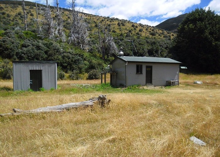
Shepherds Creek Hut
Eyre Mountains/Taka Rā Haka Conservation Park
Located in the Eyre Mountains, Southland New Zealand. Grid reference: Topo50 map sheet CD10, E1242543, N4961947.
S 45° 24.252 E 168° 25.914
Shepherd Creek Hut is located up the Eyre Creek Valley near the junction with Shepherd Creek. Access to this hut is from the head of the Eyre Creek Valley road which , at it's head, passes through private land on a Public Easement. Please be sure to shut farm gates as you found them etc and keep to the vehicle tracks. The 4WD vehicle track can take you part the way up the valley but access by car generally won't be any further than Sandfly Creek at S45°26.813, E168°27.066. After that, if in a 4WD you take your own chances. Walking from Sandfly Creek to the hut is generally only about 1.5hrs easy-moderate walk. the hut is a 6 bunk hut with a Pot Belly Fireplace. Water is from the Eyre Creek about 60ft away. Can be bad for Sandflies up here so take repellant.
|
Owner
|
Owner: DOC |
|---|---|
|
Category
|
Standard Hut |
|
Sleeps
|
Sleeps 6
6
|
|
Facilities
|
Toilet, Open fireplace |
|
Water supply
|
Natural water source |
|
Unlocked
|
This hut is unlocked and open to access. |
|---|---|
|
Bookings
|
No bookings — open access
No — open access
|
|
Altitude
|
460m |
|---|---|
|
Mobile phone coverage
|
No coverage |
|
Maps
|
NZTopo50-CD10
|
|
Link
|
www.fishnhunt.co....http://www.fishnhunt.co.nz/forum/YaBB.cgi?num=1221950338/20#20 |