Bull Paddock Creek Track
- 3 hr – 4 hr return by the same track
- Medium
Access To Bull Paddock Creek Biv from The Wairau river, this track follows Sand Fly Stream before dropping Bull Paddock Creek. Can be done as a return trip or could go over into Silversteam or lost valleys.
|
Walking time
|
1 – 3 days
3 hr – 4 hr
|
|---|---|
|
Distance
|
5.2km |
|
Type
|
Return by the same track
|
|
Grade
|
Medium
Relatively easy and well marked with permolat. Not longer maintained by DoC (since 1994) Grades explained
|
|
Bookings
|
No bookings — open access
No — open access
|
|
Maps
|
NZTopo50-BS25
|
|---|---|
|
Altitude
|
610m
–
1,340m
Altitude change 730m
|
The Wairau riverbed is private land seek permission. Pick the crossing in the Wairau carefully, hence this track is not possible after rain. Best during low to lowish normal flows. Beware of wasps during season.
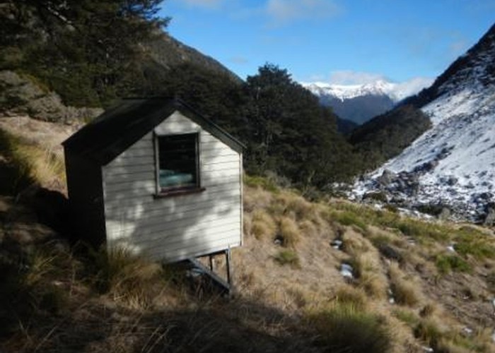
The track starts approximately 100m up Sandfly Stream, past a large slip on the true left. Permolat marks the start of the track, from here the track heads up Sandfly Stream on the true left along the edge of an very old river terrace. The track crosses Sandfly Stream about 1.5km up, from here it heads upstream a further 40m and then turns and heads up a spur. The spur starts off quite broad however begins to narrow approaching the 960m mark where the track veers off the ridge onto a steep sidle. From here sidle across a gully and into a second gully, from here head up the gully and over the saddle into the Bull Paddock Creak catchment. Descend down the other side around 40m before beginning to sidle. The track then sidles around into a step gut where it descends slightly before continuing to sidle into Bull Paddock creek. The track continues up the through open beach forest on the true left. Near the hut the track emerges into an open tussock and speargrass covered clearing. Head across the clearing and up to the hut, which is out of sight initially (the hut is actually 100m higher & upstream of where it is marked on the map).
As of 2014 the track appears to be very well marked, and relatively clear however the upper section Sandfly Creek is getting a bit overgrown with beach saplings, and there is a few old windfalls in the upper Bull Paddock Creek section.