Boyd Creek to Upukerora Link Track
- 1 day one way
- Hard
An old track linking Boyd Creek to the Upukerora via Dunton Swamp that is no longer maintained by DOC. There is no mention on this route on the DOC website, refer to Moirs Guide South 7th ed page 200 for a couple of paragraphs of vague information.
This track is poorly marked and overgrown, and in places the track as marked varies greatly from the track as mapped... sometimes with as much as 500m difference between the two. Good route finding skills are essential.
|
Walking time
|
1 day
8 hr – 11 hr
|
|---|---|
|
Distance
|
23.0km |
|
Type
|
One way
|
|
Grade
|
Hard
Route finding skills required. Grades explained
|
|
Bookings
|
No bookings — open access
No — open access
|
|
Starts
|
Boyd Creek carpark, about 14km from Te Anau Downs on the Milford Road. |
|---|---|
|
Ends
|
Army hut, on the Upukerora river. |
|
Maps
|
NZTopo50-CC09
NZTopo50-CC08 |
|
Altitude
|
320m
–
500m
Altitude change 180m
|
From the car park its a short walk up the 4WD track before a simple orange topped snow pole, like the kind that marks the tops, marks the turn off for the Boyd-Upukerora link track. Inside the trees you'll be surprised to find yourself on a well groomed, well marked, bridged, and well maintained track. What is this madness? After about 20 minutes it becomes clear that you are following a circuit track that belongs to the Boyd Creek Lodge. A cross of branches on the ground bars the way to a trail that disappears into the undergrowth. Once you start following this trail you will soon experience the real Boyd-Upukerora track... densely overgrown in places (but also nice open in others) and no more orange triangles but small clumps of pink tape or occasional permalot marker.
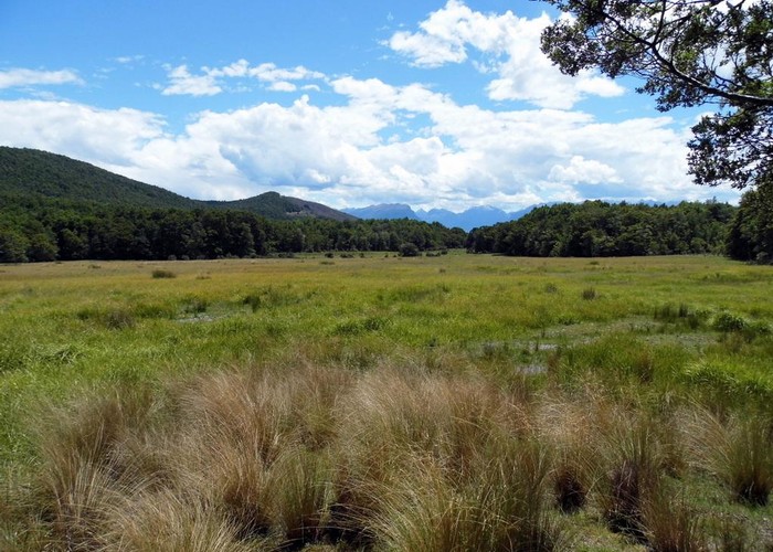
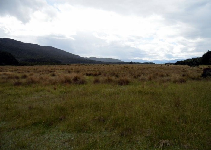
After about 30 minutes from leaving the circuit track you'll reach the first tussock/grass clearing. In December 2013 there was evidence that sheep graze here which suggests that this is private land, but hopefully the owners dont mind crossings when there are no stock present. It is far easier then trying to locate the supposed track around the sides. Another 30 minutes gets you to the Dunton Creek north branch. Between here and the south branch the track as marked reaches some 500m east of the track as mapped.
After crossing the south branch its a climb up a bit of a hill. The marked track reaches a large clear-felled clearing at CC08 040827. The map indicates that a track goes around the east of the clearing and so I wasted much time in the southeast corner looking fruitlessly for track markings. I can only suggest that other parties instead head southwest across the clearing and look further down the hill. I eventually blundered into the track at at CC08 035817. The track descending off this hill ended up again being some 500m east from the mapped one.

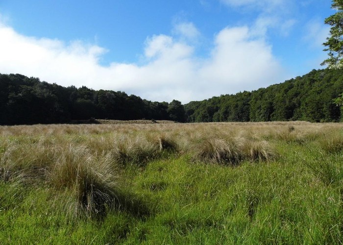
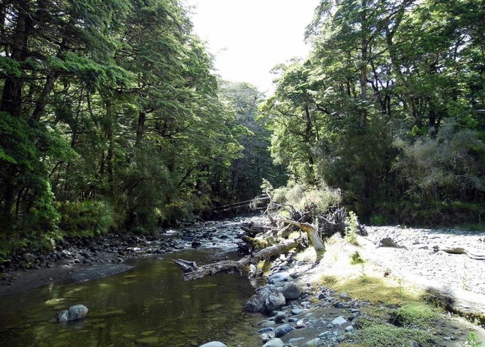
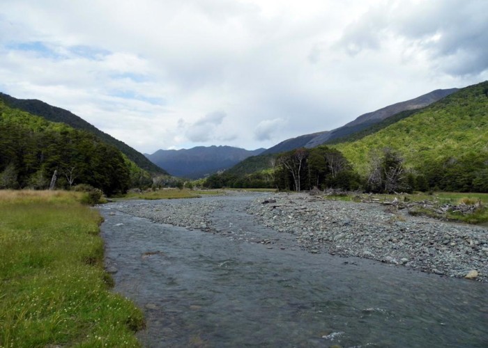
Follow the track to hit the northwest of a large tussock/grass/swamp flat and follow the stream southeastwards across it. Look for markers at the southeast corner where the map shows the track entering the trees, but instead of pink tape look for blazes. A line of ancient blazers heads uphill which is difficult to follow. Like me, you'll probably lose them and re-find them multiple times, so just keep heading southeast for about an hour. You'll eventually hit the top of Dunton Swamp. A sign out in the swamp warns against poaching, indicating that perhaps Dunton Swamp is private land. Pink tape begins to mark a trail around the eastern side of the swamp but it quickly peters out. More fruitless searching eventually concludes that the easiest travel is at the tree line around the swamp. It takes about an hour and a half to make your way down until the Upukerora river is finally reached.
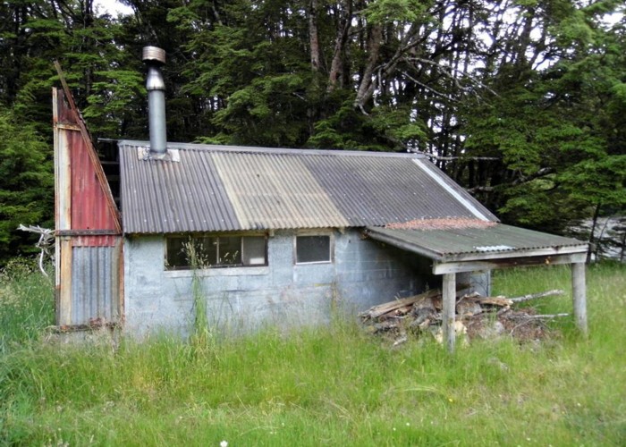
A 4WD track heads upriver on the true right so follow this, and laugh merrily at the wooden sign you soon pass that proclaims Boyd Creek only 5 hours away The 4WD track crosses the river a couple of km up from Dunton Swamp and from there its another couple of km to finally reach Army hut, some 10 hours from Boyd Creek. Army hut is easily reached by 4WDers and hunters so lives a hard life but provides warm shelter for the night.

From here the river offers the possibly of trips north to the Livingstone Mountains and Snowdon Peak while down river another unmaintained track heads south to the Whitestone and Kiwi burn rivers.