Mount Herbert: Gebbies Pass approach
- 7 hr – 7 hr 30 min return by the same track
- Easy
- Gebbies Pass to Sign of the Packhorse: 1 hour 30 minutes
- Hut to bluffs: 1 hour
- Bluffs to Mount Herbert Shelter: 45 minutes
- Shelter to summit: 15 minutes
A lengthy route along the Crater Rim, past the Remarkable Dykes and the Sign of the Packhorse to Mount Herbert / Te Ahu Patiki (919m).
|
Walking time
|
1 – 2 days
7 hr – 7 hr 30 min
|
|---|---|
|
Distance
|
19.0km |
|
Type
|
Return by the same track
|
|
Grade
|
Easy |
|
Bookings
|
No bookings — open access
No — open access
|
|
Starts
|
Gebbies Pass, Gebbies Pass Road, Teddington. |
|---|---|
|
Maps
|
NZTopo50-BX24
|
|
Altitude
|
150m
–
919m
Altitude change 769m
|
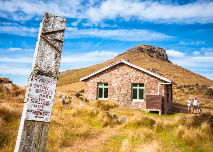
From a small car park on Gebbies Pass, a stile leads to a farm track. Follow the marker poles along the summit ridge, past the Remarkable Dykes to historic Packhorse Hut.
From the hut, follow the poled route around the southern face of Mount Bradley. The track passes through a welcome patch of forest before climbing over tussock to a high sidle just under the bluffs near the top of the mountain.
A rocky track leads under the bluffs to the southern face of Bradley's eastern spur, and wanders through gorse. Gaiters are a good idea here. The track soon crosses a fenceline and meets the track up from Orton Bradley Park. The Mount Herbert Shelter is another 10 minutes along, with the summit 15 minutes further.