Whirinaki River - Taumutu Stream
Whirinaki Te Pua-a-Tāne Conservation Park
- 5 hr 30 min – 6 hr loop track
- Medium
- Taumutu Stream, Lower Whirinaki Track to cave: 50 minutes (allow 30 minutes to explore the cave)
- Cave to Whirinaki / Taumutu Stream Track junction: 1 hour 15 minutes
- Taumutu Stream Track to Upper Whirinaki Hut: 15 minutes
- Upper Whirinaki Hut to Taumutu Stream, Mangamate Stream Track: 1 hour 10 minutes
This extension to the Whirinaki - Mangamate Loop leads past a pumice cave to Upper Whirinaki Hut. The route is rough and wet underfoot.
|
Walking time
|
1 day
5 hr 30 min – 6 hr
|
|---|---|
|
Distance
|
7.0km |
|
Type
|
Loop track
|
|
Grade
|
Medium
This route is storm damaged and lightly marked. Grades explained
|
|
Bookings
|
No bookings — open access
No — open access
|
|
Starts
|
Lower Whirinaki Track at Taumutu Stream |
|---|---|
|
Ends
|
Mangamate Stream Track at Taumutu Stream |
|
Maps
|
NZTopo50-BG38
|
|
Altitude
|
620m
–
750m
Altitude change 130m
|
The tracks along the Whirinaki and Mangamate Rivers form a classic circuit of Whirinaki Forest Park, which is described here: Central Whirinaki - Mangamate Loop. Where the loop meets Taumutu Stream, it is possible to continue onward to Upper Whirinaki Hut. These tracks are rough underfoot with a lot of windfall and snow and storm damage. Look for blue ducks in the rivers along the way.
South of Central Whirinaki Hut, the Whirinaki River meets Taumutu Stream at a bridge. Instead of following Taumutu Stream, take the trail to the right (south), which meanders above the Whirinaki River. After about 50 minutes, the track branches, with the route right (west) leading out to Plateau Road. Take the route to the left and over a swingbridge.
A pumice cave is here, leading into the hillside about 40 metres. Small pieces of charcoal embedded in the walls are remnants from the Taupo eruption in 182AD. This eruption clothed the central North Island metres deep in pumice.
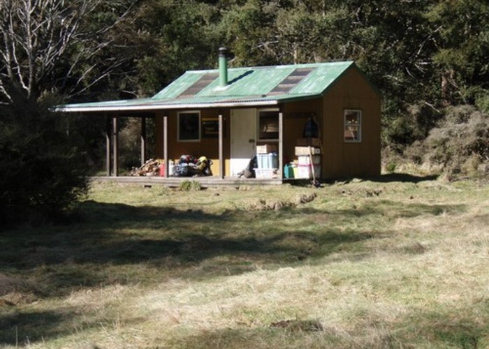
From here, follow the Whirinaki River on a very rough and damaged track. The route picks its way along the river, crossing frequently. Eventually, the track meets a junction, Take the left branch to Upper Whirinaki Hut, which is situated in a clearing nearby.
Backtracking slightly, the Taumutu Stream Track heads north up a dry valley, over an easy saddle, and down a muddy trail along the stream.
The Mangamate Stream Track kicks off where Kakaiti Stream enters from the right. It's an easy-to-miss junction, with the straight-ahead route leading back to the bridge on the Whirinaki River -- about 30 minutes on a rough trail, or continue along the Mangamate Track to River Road.
Walking times: