Forks Hut, Diggers Hut and Te Ekaou Hut access
Ruahine Forest Park
- 1 – 2 days one way
- Medium
- Takapari Roadend to Forks Hut via rough ridgeline track
Several public and private access routes into these huts in the southern Ruahines and suggested round and though trips.
|
Walking time
|
1 – 2 days
6 hr – 12 hr
|
|---|---|
|
Distance
|
10.0km |
|
Type
|
One way
|
|
Grade
|
Medium
Riverbed travel, tracks and ridgeline routes Grades explained
|
|
Bookings
|
No bookings — open access
No — open access
|
|
Starts
|
Pohongina Vally East Road - Te Ekaou or Makawakawa Bridges |
|---|---|
|
Ends
|
Takaparui Roadend |
|
Maps
|
NZTopo50-BL35
NZTopo50-BL36 |
|
Altitude
|
180m
–
1,060m
Altitude change 880m
|
Routes into Forks Hut and Te Ekaou Hut
Several routes, both public and private, exist into these hut in the southern Ruahines:
Additionally private (permission required) routes exist across farmland:
Te
6km, 2-4 hrs, river / ridgeline route
A 10m wide marginal strip runs up either side of the Te Ekaou Stream, providing good access as far as the
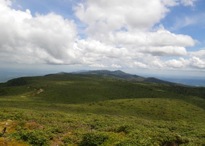
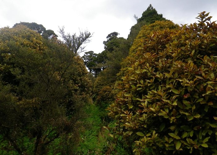
As shown on the map, a farm track follows the west bank of this sidecreek to the hut, but this runs over farmland and as such permission is required. Instead, climb the ridge to the east of the sidecreek - the first ridge within the park boundary, to reach a stand of pines above. It's a steep tough scramble out of the creek, a slip 50m upriver provides access. Once on the ridge, things improve considerably: a roughly cut track follows the ridge first E then NE running parallel to the park boundary about 300m from the bushedge. At first this runs through scrub 2-3m high, but later enters remnants of mature bush. After about 1.5km a junction of ridgelines is reached marked by a patch of windfall: a ridge runs NNW 800m to Te Ekaou Hut, and the main ridge swings east to intersect the Forks Hut track shortly before it descends to Forks Hut.
For those heading to Forks Hut, continue east along the main ridge until the Te Ekaou Hut to Forks Hut track is intersected after about 500m. It's a broad, marked, cut DOC track and you can't miss it.
Heading to Te Ekaou Hut, the shortest route is NNW along the ridgeline directly to the hut. An old cut track runs along this ridge, hitting the 4wd track 100m SW of the hut. However, this ridgeline track has been all-but obliterated by windfall and it is very hard going. Heading west to the cut track and doubling back is probably faster,
3km, private 4WD track
Over half of the visitors to Te Ekaou obtain permission from the farmer to walk / drive up the farm track to the DOC boundary at Te Ekaou Hut.. This is 3km along a 4WD track and permission is essential. Contact DOC for landholder details.
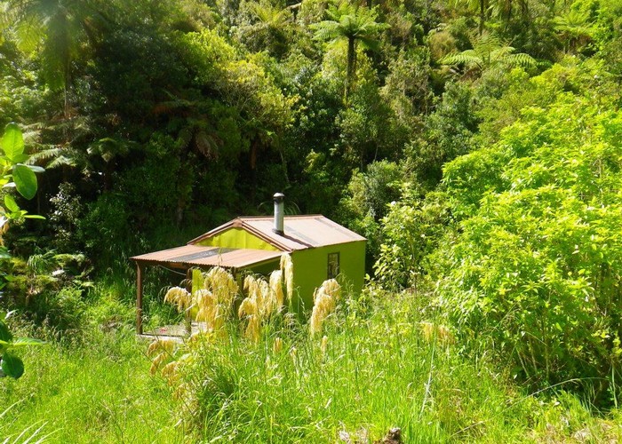
Te Ekaou Hut
Te Ekaou is a tidy, spacious 6-bunk hut just inside the bushedge. There's a wood burner and tank water.
Te Ekaou Hut to Forks Hut
Cut marked track, 2km, 45 mins - 1.5 hrs
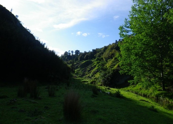
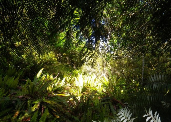
Heading east from Te Ekaou, a well maintained, broad cut and marked track descends to the creek and climbs steadily to the ridge beyond. The area is regenerating bush, with occasional mature trees standing tall above the low canopy - left as seed trees, or unsuitable for logging - I'm not sure. Reaching the lip of the Makawakawa valley the track drops precipitously to the creek. Forks Hut lies on the far bank, upriver of the forks.
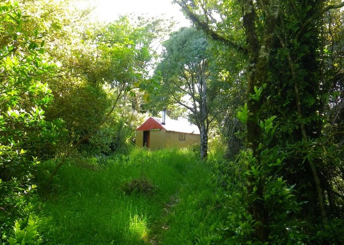
Forks Hut
Forks hut is another 6-bunk ex-forestry hut. Again featuring a pioneer stove, and with water from the creek 10m away From behind the long-drop a rough track climbs to the ridge south of the hut, between the two forks. Opposite the hut to the NW, a DOC 'animal control' track marked with pink triangles climbs to the ridgeline. I do not know if this connects with the other pink-triangled 'animal control' track descending the same ridgeline from
Makawakawa Stream bridge (
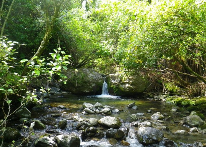
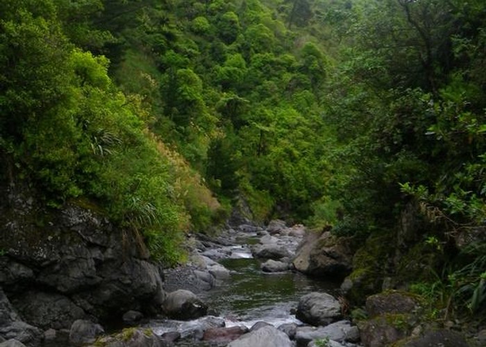
Riverbed route, 6km, pools and waterfalls to navigate
I've only walked the lower section of this route, but hut book entries confirm that it is possible to travel up the river from the
Above the forks, the southern tributary leading to Forks Hut is small, but narrow and gorged. Hut book entries mention that several waterfalls and pools have to be negotiated and the route is not recommended after rain.
Forks Hut to
1. River route, 6km, 2.5-5 hrs
The northern branch of the creek, starting at Forks Hut, provides mostly good going until 500m from its head. Initially river banks are covered in thick scrub and regenerating bush, and travel in on river gravel and rocks. A waterfall is reached after 1km which requires a brief but steep scramble - the true left worked for me. Above the falls, the valley opens a little, and scrub is replaced by grassy banks and open valleysides, with clearings on the valley floor providing good camping spots. Bush is replaced by 2-3m high scrub and slopes are dotted with fern trees - though occasional standing totora remain here too. About 500m before the next forks, a DOC animal control track marked with pink triangles climbs to the ridgeline to the north. It is a fair assumption that this joins that dropping from
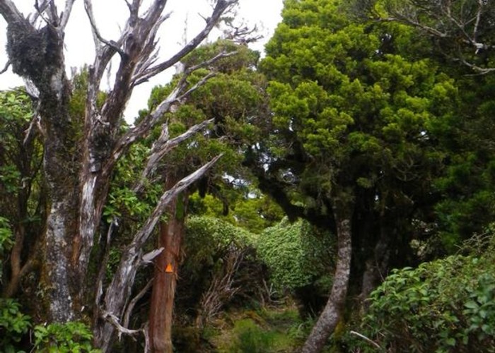
I ignored the track and headed on up the river which continued to provide good travel. Another waterfall just beyond the track required another scramble - true left again did it for me. Taking the northern branch at the next forks, climbing more steeply I entered thatcopper-coloured scrub that warns that leatherleaf is not far above. Going remains good until a tall 20m waterfall is encountered about 500m from the head of the creek. Take any good-looking route up to the ridgeline to the north - there are several grassy slips below the falls, and gentler wooded creeks just above. All provide reasonable access to the ridgeline. On reaching the ridge you'll pick up a cut, well-marked ridgeline route heading for the summit and
The ridgeline route is marked with pink triangles and cut in places through scrub. On reaching the leatherleaf it becomes a 1.5m wide cut track, though as you climb higher the leatherleaf starts to encroach more and more. The last 30m are uncut - presumably to hide the track for some reason. The track reaches the
Forks Hut to
I'd bet that the DOC pink triangle track climbing from 1.5km above Forks Hut and the DOC pink triangle track descending from Takapari Rd join up.
I reckon also that the DOC pink triangle track climbing opposite Forks Hut and the other two DOC pink triangle tracks probably also join up.
Someone can go and find out and report back. If so - you'll knock at least half an hour off the above times.
Takapari Roadend to Travers Hut
4wd track, 5km, 1-1.5hrs
It's a 5km, 1hr stroll along the 4WD
Travers sleeps about 4 on one platform but has no matresses and no woodburner. There is, however, tank water.
Cut track plus 1km of river travel: 6km, 1.5-3 hrs
The track from
The broad cut and marked DOC track leaves
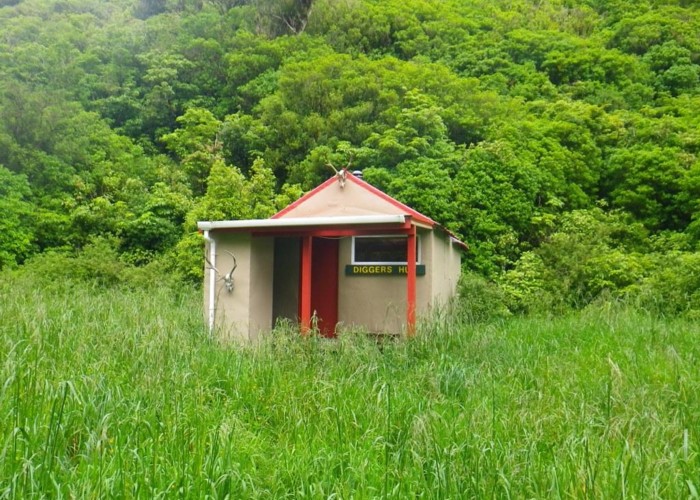
Diggers Hut
Diggers Hut is the same size as Te Ekaou and Forks – but has only 4 bunks. There’s a pioneer stove and water from the river. The toilet and meatsafe are some 20m away downstream.
Riverbed route – 6km, 2.5-5hrs
Makawakawa stream is much larger and wider than Te Ekaou, and the banks are forested throughout meaning travel is on the riverbed almost all the way. However the bed is broad and for the most part travel is on gravel and stones. Many crossings are necessary – mostly knee deep. In places however, the valley gorges out and crossings of deeper pools are required – waist deep when visited after intermittent overnight rain. Below the forks leading to Forks Hut, the valley becomes shallower and travel easier. Grassy flats are present in places making travel easier – but rampant budlia soon appears choking the banks and pushing you back into the riverbed. It should be possible to cut onto the road running adjacent to the stream at its lower end – but by this point travel is so good that continuing to the
7km, farm track to bushedge, DOC track beyond
Head 100m downriver of the hut and look for the large DOC triangle on the opposite bank marking the start of the track. The track climbs steeply up the valleyside and is overgrown (2011). It later crosses farmland to reach the roadend adjacent to Makawakawa Stream. Landowner permission is essential – contact DOC for details. About ¼ of visitors to the hut use this private track – so access clearly is granted on occasion.