Moerangi Circut
Whirinaki Te Pua-a-Tāne Conservation Park, Te Urewera
- 2 – 3 days one way
- Easy
Promoted as a mountain bike track, this is also a popular tramping track. The track is very new, well graded, easy and suitable for trampers of all ages in virtually any weather.
|
Walking time
|
2 – 3 days |
|---|---|
|
Distance
|
33.6km |
|
Type
|
One way
|
|
Grade
|
Easy |
|
Bookings
|
No bookings — open access
No — open access
|
|
Starts
|
River Rd, Minginui |
|---|---|
|
Ends
|
Okahu Rd |
|
Maps
|
NZTopo50-BG39
NZTopo50-BG38 |
|
Altitude
|
395m
–
920m
Altitude change 525m
|
This track can be done by mountain bike in about 6 hours but it is also a good, very well graded tramping track.
Gary Aldridge from Whirinaki Forest Lodge (Ph 07-366 3235) in Te Whaiti can provide transport to the beginning and end of the track.
River Rd to Moerangi Hut (5 hours)
The track begins at the River Rd carpark near Minginui. Follow the track toward Central Whirinaki Hut but take a hard left hand turn about 500m past the bridge over the canyon.
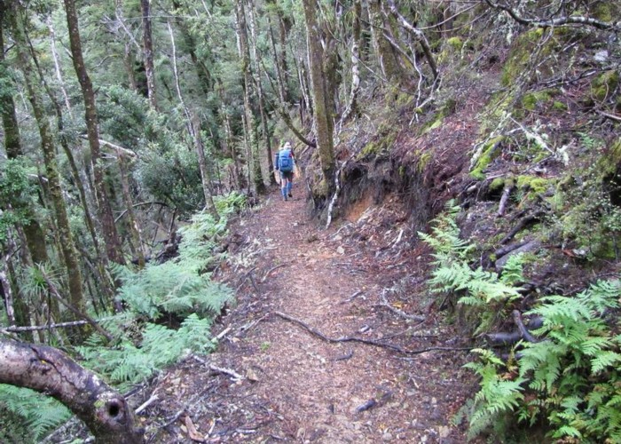
The track climbs steadily for about 100m and then follows an old forest road along a ridge line. After a couple of kms, and just over an hour from River Rd, another sign post marks the beginning of the track to Moerangi Hut.
The route now climbs steadily and consistently up the right hand flank of the hill. After about 300m of climbing and about another hour the track passes a clearing, a helicopter pad left over from the construction of the first track up this hill. This a good place to stop for lunch if it is sunny.
The track climbs a little more along the flank of Moerangi and then begins to descend towards Moerangi Hut. On the way, another more recent helicopter pad is passed. This is from the more recent track construction and has a picnic table.
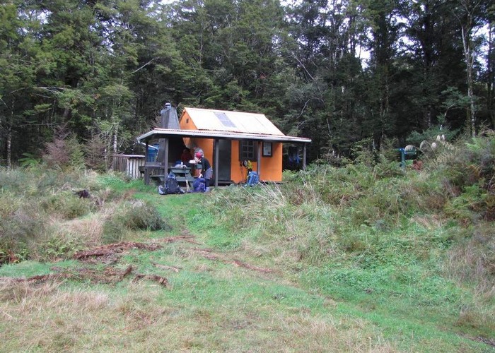
It is all downhill from here and the track winds down alongside Moerangi Stream, until after another hour, we arrive at a bridge which crosses above the junction of the two branches of the Moerangi Stream. Another 50m and take the right hand turn. 10mins up the other branch takes you to Moerangi Hut
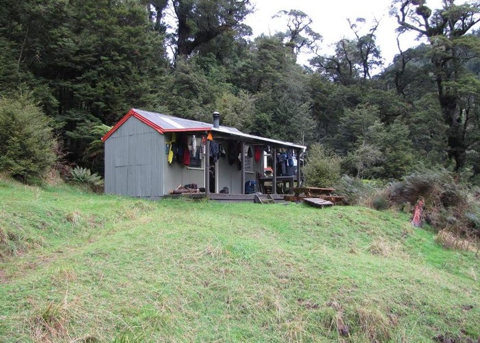
Moerangi Hut to Rogers Hut (3 hours)
From Moerangi Hut go back to the stream junction and follow the track to Rogers Hut. It is 3 hours easy travel to Rogers. The track traverses high on the true right side of the valley all the way. About half way down another helicopter pad provides another welcome rest spot.
An alternative to following the mountain bike track is to follow the scenic route down the river bed. Notes in the hut books show this to be a popular alternative for those with the time and in low water. It is about 4 hours by this route or a little longer for those unused to off track travel.
Rogers Hut to Okahu Rd (3 hours)
From Rogers Hut the track crosses the Moerangi Stream on a bridge and then continues in its high quality fashion. It crosses a low saddle and then descends to Skips Hut. From Skips it climbs to another low saddle and soon after that it comes out at the Okahu Rd carpark.