Matiri Valley to Wangapeka Saddle
Kahurangi National Park
- 4 – 6 days one way
- Medium
An interesting cross country trip in Kahurangi National Park involving a stretch of unmarked ridge travel
1 member favourited
4 members checked in
|
Walking time
|
4 – 6 days |
|---|---|
|
Distance
|
66.0km |
|
Type
|
One way
|
|
Grade
|
Medium
No markers above bushline between Hurricane Hut and Wangapeka Saddle Grades explained
|
|
Bookings
|
No bookings — open access
No — open access
|
|
Starts
|
Matiri West Bank Rd |
|---|---|
|
Ends
|
Rolling Junction Wangapeka Valley |
|
Maps
|
NZTopo50-BQ24
NZTopo50-BQ23 NZTopo50-BR23 |
|
Altitude
|
228m
–
1,504m
Altitude change 1,276m
|
To Matiri Hut 3hrs
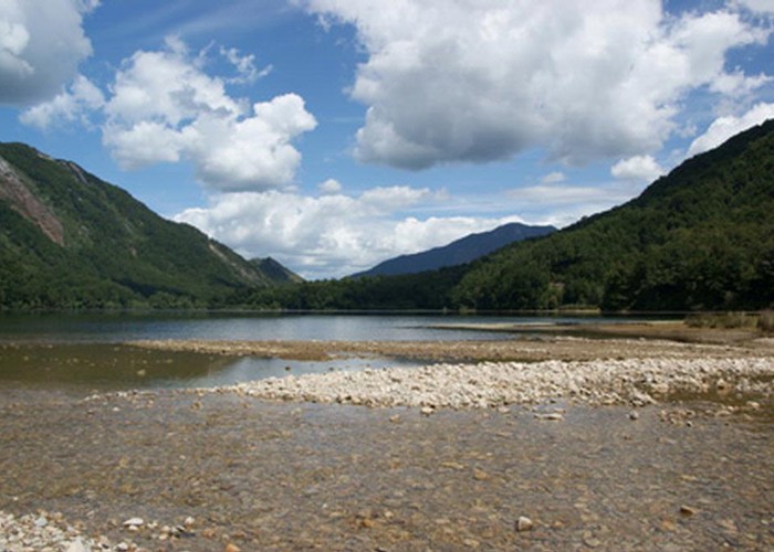
From the end of the road it is a gentle wander up a farm track to the where the West Branch of the Matiri is crossed. This could be a barrier when in flood. After this the track enters the bush and climbs for a short distance before arriving at Matiri Hut which overlooks Lake Matiri.
Matiri Hut to McConchie’s Hut 6hrs
From the hut the track descends to where the fan of Bay Creek enters the lake. On the far side a sign post points upstream to McConchie’s Hut while another indicates the steep climb up to Poor Pete’s Hut. The track pedantically follows the true right of the valley and avoids the river bed at all costs. Going can be a bit rough from time to time as recent windfalls and river bank washouts make going tough. The track climbs high above the river to avoid obstacles on two occasions. It may be possible to make up a bit of time by taking to the river bed from time to time when the river is low.
McConchie’s Hut to Hurricane Hut 6hrs
The track continues up the Matiri valley in similar fashion to earlier, passing through an old landslide of huge boulders at one point. After a couple of hours the track veers away from the river and into a wide side valley. It continues up the flank of this and then climbs up an old slip onto a ridge between the valley and the main Matiri Valley. It now becomes a pleasant wander up through beech forest along the crest of the ridge. Views to the north show a lake in the Main Matiri Valley floor, obviously caused by the 1929 earthquake with drowned tree stumps still visible.
The track drops off the ridge again to the left and enters are large and pleasant clearing. After crossing a second clearing it veers right again and pleasantly wanders down a, mostly dry, stream bed. It then climbs again, parallel to the Matiri River until coming out in open country next to Lake Jeanette. The open going continues and Hurricane Hut can be seen up the valley well before you get there.
Hurricane Hut to Tarn 4 hrs
Most guides speak of doing the trip from Hurricane Hut to Stone Hut in one day. I suggest making the journey a bit more relaxing with a camp at the tarn. The track climbs directly from the hut to the summit of 1442. This is well marked and there are warratahs above the bushline. However this is the end of the markers and you are on your own route finding from here. The first part of the ridge to the tarn is wide and grassy. There is one established tent site at the tarn but room for another couple of tents could be found. There is another smaller tarn to the south east of point 1398, down on the bushline. I didn’t go there but it may provide more sheltered camping in stormy weather.
Tarn to Wangapeka Saddle 8 hrs
A patch of bush covers the ridge just past the tarn but is open and easy going. A patch of scrub further on is easily passed by dropping slightly to the west of the ridge line where the canopy is higher. After that the ridge narrows and is rocky and steep in places but provides some exhilarating travel as it winds and climbs between a number of little summits. The final and highest summit is Nugget Knob which has been prominent on the skyline ahead. To finish off a narrow steep ridge descends from Nugget Knob and a little bluff, which blocks the ridge, can be turned to the right. After this a round grassy ridge heads down to bushline where a large orange triangle indicates where the track enters the bush. It then descends directly to Wangapeka Saddle where it joins the main Whangapeka Track and the short descent to Stone Hut.
ID 6626
About this track
121 views in the past year (10 per month).