Mangapurua Valley - Bridge to Nowhere Track
- 2 – 3 days one way
- Easy/medium
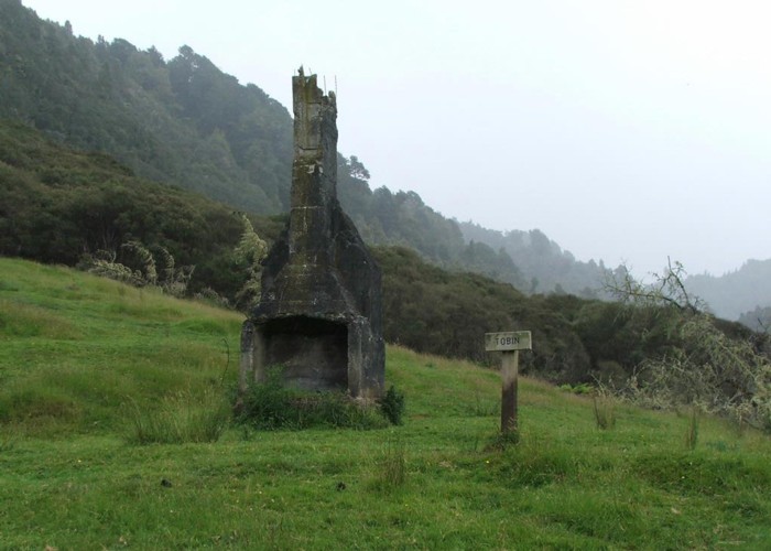
Historic track between the Whakahoro and Mangapurua landings on the Whanganui River. From Whakahoro it follows the Kaiwhakauka stream until the base of the road to the Mangapurua Trig and the Ruatiti track junction. From there it descends into the Mangapurua Valley past the Mangaiti track junction and links up with the Mangapurua stream. The DOC times are 8 hours (16k) to the Mangapurua trig, 6 hours (10k) to Bettjeman's old house site and another 6 hours (10k) to the historic Bridge to nowhere. From the bridge it is another 40 minutes to the Mangapurua Landing on the Whanganui river.The track follows the old 1917 settlers road, which was built to provide a link between the landing, where river boats dropped supplies and the old Ruatiti road. All along the track are the signposts of the various land allocations, along with some of the ruins of some of the more successful habitations. It is well worth studying the history of the area before embarking on the tramp.
|
Walking time
|
2 – 3 days
16 hr – 22 hr
|
|---|---|
|
Distance
|
40.0km |
|
Type
|
One way
|
|
Grade
|
Easy/medium
Can be slippery around the bluffs during wet periods. Grades explained
|
|
Bookings
|
No bookings — open access
No — open access
|
|
Starts
|
Wahahoro - Wades Landing |
|---|---|
|
Ends
|
Mangapurua landing |
|
Maps
|
NZTopo50-BJ32
NZTopo50-BH32 |
|
Altitude
|
65m
–
661m
Altitude change 596m
|
|
Link
|
www.whanganui.co.nz/Mangapurua.php#http://www.whanganui.co.nz/Mangapurua.php# |
|---|