Mount Herbert Walkway
- 4 hr 30 min return by the same track
- Easy/medium
- Ascent: 2.5 hours
- Descent: 2 hours
A straightforward climb from Diamond Harbour over farmland to the highest point on Banks Peninsula: Mount Herbert / Te Ahu Patiki (919m).
|
Walking time
|
1 day
4 hr 30 min
|
|---|---|
|
Distance
|
15.0km |
|
Type
|
Return by the same track
|
|
Grade
|
Easy/medium |
|
Bookings
|
No bookings — open access
No — open access
|
|
Starts
|
Jetty, Diamond Harbour |
|---|---|
|
Maps
|
NZTopo50-BX24
|
|
Altitude
|
Sea level
–
920m
Altitude change 920m
|
Note that the walkway crosses private farmland. It may be closed from August to Labour Weekend or during times of fire risk. From Lyttelton, drive around the bays to Diamond Harbour or take the ferry.
This route provides a very even grade, following the dip slopw of a long smooth lava from from sea level to the summit. It is fully exposed to the sun and weather, and somewhat dull walking over farmland.
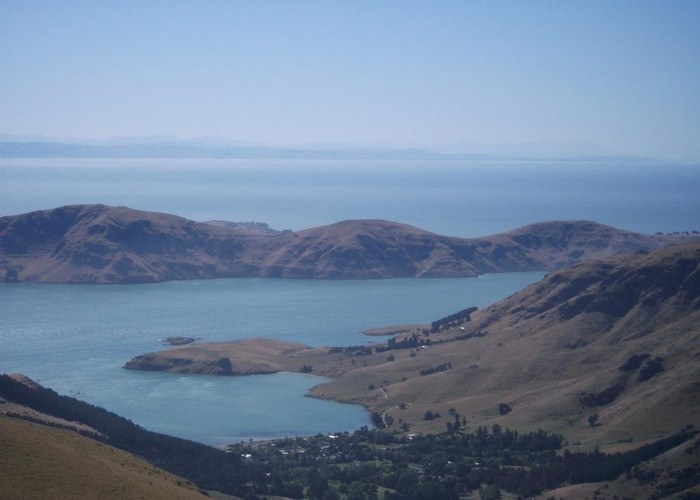
From the small Diamond Harbour village centre, follow the road down to the wharf. There is limited parking here. Walking back the road, a track leads off to the right, dropping to the beach in a few minutes. When Mark Stoddart arrived at this beach in 1851, he was captivated by the sun glinting on the water and so named Diamond Harbour.
From this beach, a rough track heads directly uphill, following a rather dry creek through scruffy pine forest and straggly bush. Ignore any side trails and keep to the creek. The track soon crosses the main road at a bend (you could also park here) onto scrubby farmland. You soon pass a large eucalypt. This is a karri tree (Eucalyptus diversicolor), one of the world's tallest species, believed to have been planted here by Stoddard in the 1860s.
The track soon crosses a dirt road. This is the final point within Diamond Harbour you could start the track, cutting about 30 minutes off your walking time. The track climbs into farmland and passes the remains of Gideon Henderson's cob cottage. The gum trees he planted have matured to form a large square, outlining a garden that no longer exists.
The Diamond Harbour volcanic eruptions six million years ago were the last to occur on the peninsula. A series of thin lava flows (called the Stoddart Formation) formed the gentle slope you are climbing. Platy slabs of bluish rock littering the track are pieces of these lava flows.
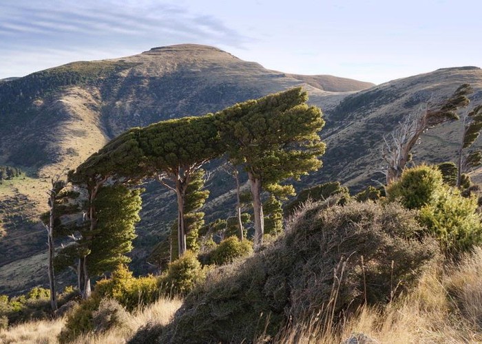
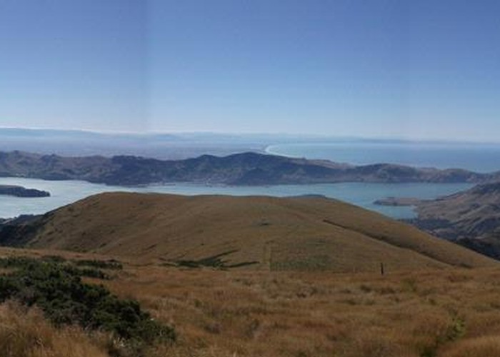
After 1.5 hours, the track levels off briefly and soon meets a 4WD track. Very near the summit, a junction indicates 10 minutes left to the summit, or 15 minutes right to the shelter. There is surprisingly little obvious change in the vegetation as you climb. The summit is dominated by tussocks, and a few speargrasses are scattered around. When I climbed, the summit was completely enshrouded in cloud so there was no view at all. A few cows were standing around the trig or sheltering by a small antenna building. From here the nearest higher points are the equidistant Mounts Thomas (1023m) and Grey (933m) 66km to the north. To the east is clear ocean all the way to Chile and Patagonia.
Walking times