
Tuesday 17th March 2009
Get up, lazy pom, get up. The kilometers could be rolling under your wheels right now, get out there, get to the roadend, get on the hill. No point lying here stressing over things beyond your control. The pack’s already half packed – just need to throw in newly dried clothes, write out my itinery, and leave. Huxley -> Broderick pass -> landsboroughugh -> valley head. Possible exit routes: Karangarua, Jacob’s, … Out Monday, Panic Friday. Attn: the store manager, who volunteered the night before to be the official point of contact. Consider emailing details to tramping friends, just in case. But what’s the point: Dennis says he will do the job, and I have the beacon in my survival pack for immediate rescue if the worst comes to the worst, so route details are likely only to be used to find a body.
Job’s done.
The long drive to Ohau.
Elect to miss Dansey’s Pass: frustrating though shorter. Past Macraes: at work under spotlights even at this hour, to the coast at Palmerston. Dawn, Moeraki, a flat sea. Flat enough to iron a shirt on. Where does that phrase come from? Oamaru, Kurow and breakfast. Omarama and Diesel. More breakfast. Daylight in the place of light. On past
Push on: should be able to get half way to Monument in the van, avoid the long 9km trudge on a 4wd track beside the
The slog to Monument
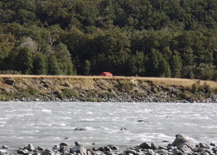
The only word for the track from Huxley Lodge to the Huxley – Dobson confluence is a slog. 9km along river rocks and 4wd tracks. Forced march. Past Monument hut – don’t call in as
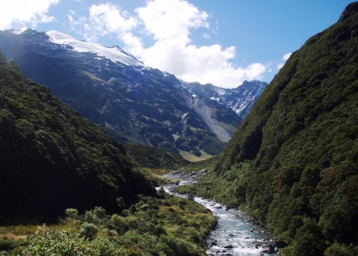
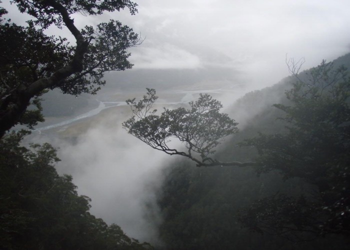
Splash up the Huxley, under the swingbridge, up the flats in burning sunshine. Lament the lack of sunhat and sunscreen: planned on hypothermia, not sunstroke. Never mind. On reaching the spot where The Retards were airlifted out last year dog runs around like a mad thing: too long time for scents; the memory must have kicked in though. ‘I remember people here: they gave me food whilst they smoked dope & waited for the rescue choper. I like food.’
And on to the forks hut. Missing as usual the dry track across the marsh, and up to the knees in mud 100m short of The Forks. The hut book shows
Sidle path to Broderik: last trip showed this to be easier and faster than the creek.
Wednesday 18th March
Drizzle starting at dawn, so it’s a quick bowl of muesli: scotch oats, sugar, power milk and cold water: the great discovery of the trip from Palmy to Otago: it’s not necessary to cook scotch oats. Cold they make muesli, hot they make porridge. Saves gas, time and the need to belch porridge all day.
Drizzle setting in, so lets get the pass over with before the rain arrives. More intentions in the book: Fraser Hut , The Landsboro, Karangarua / Douglas and beyond. And we’re off: dog rushing ahead. The original good keen man.
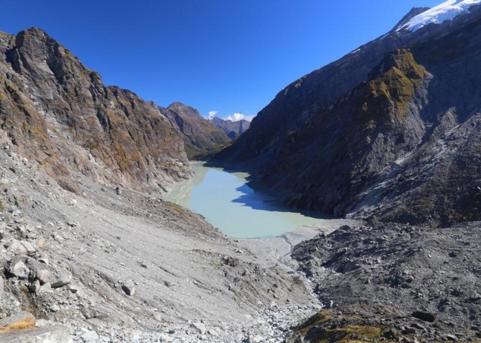
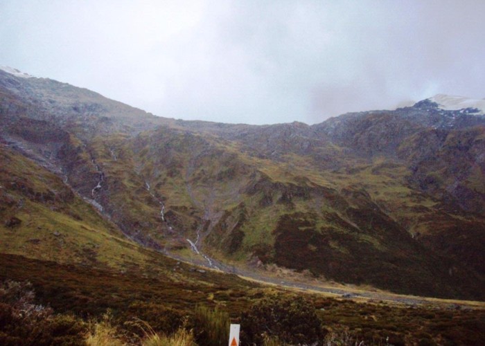
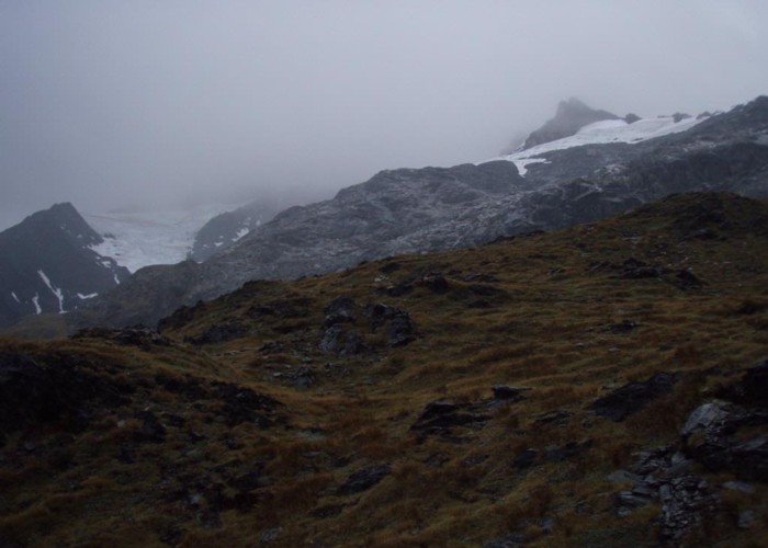
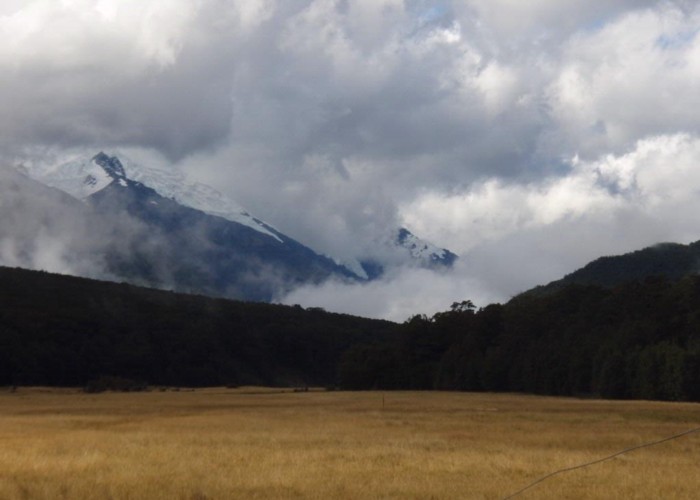
Markers up the pass, following the dog out of habit. End up dropping off the ridge into a gully on a deer track. Guess she’s following deer, not people: don’t follow the dog, pom. Scramble back to the ridge through sub-alpine scrub, and on and on and up to wet rock and scree. The glaciers of Mt Strauchon appearing and vanishing into cloud, rain and mist. Slow going over slippery rocks, but we make the pass in the end under a biting wind. My first, long awaited, view of the real landsborough: flats at the Haast road aside. But the landsborough is not there:
Another cairn marks the 1st ridgeline: a beautiful campspot popularity shown by a series of fire-rings. The dog succumbs to temptation and heads down the ridge from here, but my recollection is that the main ridge must be attained first. Heading due south, above the largest upslope fire-ring, we pick up markers heading directly up the steep, slippery and muddy slope for the ridgeline. The markers hang around for just long enough to give us the idea before petering out, though the track is well trodden: it’s straight up from here boss.
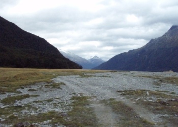
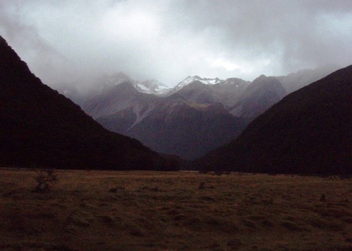
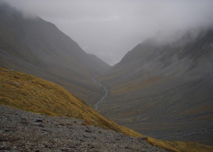
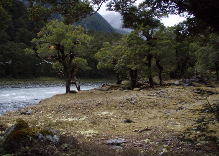
We fight and win, gaining another 200m of altitude by the damp ridgeline of stunted beech. The track latches onto this and follows it steeply down, mud and wet leaf underfoot, dropping rapidly into the ocean of cloud below. 400m above the valley floor we finally break though: the grassy flats and river channels of the Landsboro visible at last. Beech faces surrounding them, narrowing in places to tree-clad gorges before opening to more flats beyond. The peaks above are hidden in the cloud, now above us, and the result is a pleasent lowland valley topped by a cieling of grey. No hints of the glaciers, rock ice and hanging valleys above are visible.
Down, down, down and the track becomes more and more indistinct, before disappearing completely 100m above the western fork of
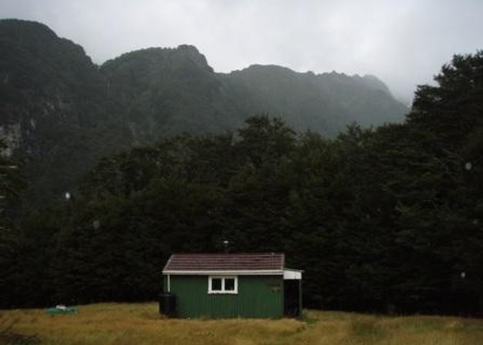
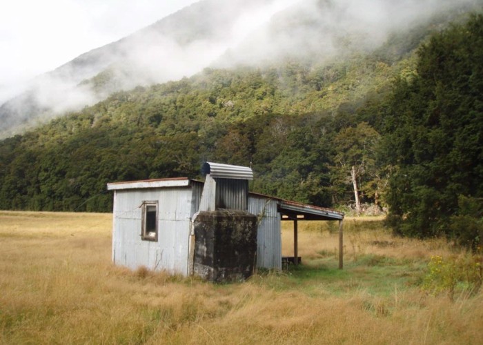
Passing stoat traps on the way: all empty. Splash, splash back through the creek: the rain heavy now, and through long wet grass onto the river terraces and to the welcome sight of Fraser Hut. Off with wet clothes, wet pack. Fire lit, pack emptied, gear and pack hung up to dry, sandflies fed and the billy on the boil. Mountain radio aerial put to good use: Radio NZ international’s coming in strong, and we’re hanging out for a forecast (rain clearing by morning: sweet).
The hut has 4 bunks: the top two being a foot or so below the roof, and 7 ft above the floor. Strange set up, but it works: just don’t sleep-walk. Concrete floor rotting a bit but a warm, fully lagged hut. Veranda, water tank and all the sandflies you can feed. Perfect.
Thursday 19th
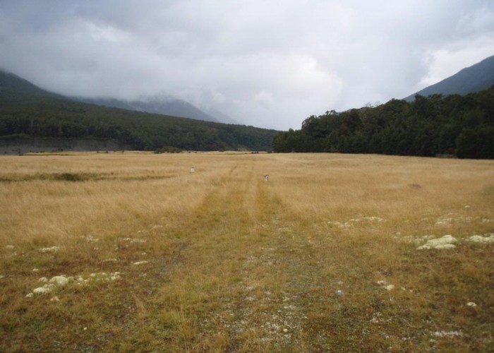
The biv across the river at Toetoe Flat looks in good condition, though the water prohibits any recce’s to investigate further. Beyond here things get easier. The southern face of the Landsboro becomes more gentle, and sidling easier. We climb to river terraces on the way to Ford Flat, dropping back to the river later for Kea. Sidling close to the water along a marked
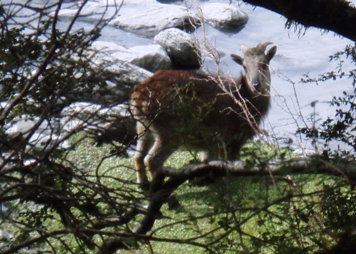
Dropping into McKerrow, we scramble up the far side and drop finally to Hinds Flat. No hinds in sight, but a couple of Tahr provide entertainment. From here up it’s boulder hopping and river flats all the way. The flats criss-crossed with deer and tahr tracks: all made since last night’s rain. A good sight to see, in the face of
Every side creek provides grassy terraces and ideal camping spots abound. A good valley in which to have a tent. And lucky too: our planned objective of the rock biv’s at the valley heads proves too much, and a night under canvas follows beside
Part 2