Urchin-Umukarikari Loop Track
Kaimanawa Forest Park
- 1 – 2 days loop track with a road section
- Medium
This is a new track linking the existing Umukarikari Track that goes to Waipakihi Hut with the Urchin Track that goes to the lower Waipakihi Valley. This now makes a day loop possible and on a good day there will be fantastic views of Lake Taupo, Tongariro National Park and the mountains of the Kaimanawas across the Waipakihi Valley.
As at December 2008 this track is usable but not complete. There is a 120m section of bush that is rougher going but is well marked. DOC have put some blue poles on the upper
|
Walking time
|
1 – 2 days
8 hr – 10 hr
|
|---|---|
|
Distance
|
17.0km |
|
Type
|
Loop track with a road section
|
|
Grade
|
Medium |
|
Bookings
|
No bookings — open access
No — open access
|
|
Starts
|
Umukarikari Track off Kaimanawa Rd |
|---|---|
|
Ends
|
Urchin Track off Kaimanawa Rd |
|
Maps
|
NZTopo50-BH35
|
|
Altitude
|
760m
–
1,482m
Altitude change 722m
|
This track begins from the Umukarikari carpark which is off Kaimanawa Rd.
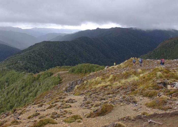
Start up the well-formed track that goes to Waipakihi Hut. After two hours of steady climbing in the bush you will come out onto the open tops. The route from here is marked by white wooden poles but a lot of them have fallen over so take care when route finding.
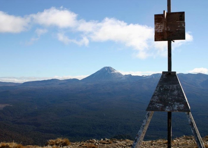
The track steadily climbs over open country with good views of Taupo and the Tongariro Volcanos behind you.
Just before reaching Sharp Cone, this route turns off the main track and follows a wide ridge heading south. As at December 2008 DOC had started to mark this route with blue poles. This work will soon be complete and there will possibly be a signpost at this junction.
After about 20 mins you pass a stream fed by a large spring. This is a good place to fill up with water if you need it.
The route continues down the ridge and descends to the bush. A prominent ridge leading to Urchin can be seen ahead. The entry into the bush is marked with a large orange triangle. The track is newly cut and quite raw. It descends initially and then slowly climbs. And then finally the ridge narrows, forcing the track into some steep up and downs.
After passing through a small clearing and about 2 hours after entering the bush, the track comes out of the bush again. Continue to climb along the ridge and then just over a knoll the route intersects with the track climbing out of the Waipakihi Valley. It is only a short way down to water on the western side of the ridge, if you need to fill up here.
The old track follows poles to the Urchin trig, which is reached in about 30 mins. This is one of the most spectacular views in the area. The panorama goes from Lake Taupo in the north to Ruapehu and the Desert Rd to the south.
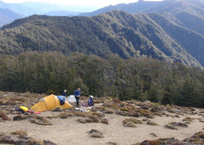
The track then follows poles down in the bush, which is soon reached ands the track descends steadily. A good camping site may be seen down a short side track and there is a good water source in the bush about 20m from the camp site.
Continue down in bush until the track comes out a short distance below the Rangipo surge chamber.
It is a long boring walk back around to the Umukarikari carpark from here so it is better if you can arrange to have a car waiting to pick you up if possible. There are tourist operators in Turangi who can do this for you.