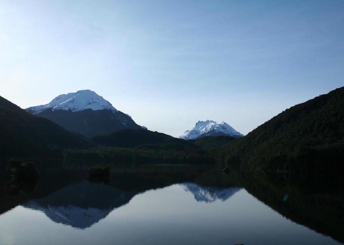
Lake Sylvan
Mount Aspiring National Park, Te Wāhipounamu - South West New Zealand World Heritage Area
- 1 hr – 1 hr 45 min loop track
- Easy
A short forest walk to a tranquil lake.
|
Walking time
|
1 hr – 1 hr 45 min |
|---|---|
|
Distance
|
6.0km |
|
Type
|
Loop track
|
|
Grade
|
Easy |
|
Bookings
|
No bookings — open access
No — open access
|
|
Starts
|
Sylvan Campsite, Routeburn Kinloch Road, Head of Lake Wakatipu |
|---|---|
|
Maps
|
NZTopo50-CB10
|
|
Altitude
|
370m
–
376m
Altitude change 6m
|
From the Lake Sylvan Campsite (ample grassy space, toilets), a swingbridge leads across the Route Burn. The track sets off through a red beech forest that was once shingle river terrace. The forest is rich in bird life, including rifleman, kakariki, kaka, tui, fantail, robins, and even the rare yellowheads. Passing a junction, the track crosses a bridge and reaches the serene lake in 30 minutes.
From the lake, A longer return journey follows an old logging tramway back. Continue along the lake edge into mountain beech / toatoa / totara forest, to a junction after a few minutes. The route back turns right, onto the tramway and through logged red beech forest. Soon, the route crosses a little creek and closes the loop. Turn left, and it is 25 minutes back to the campsite. Total walking back along the tramway is 1 hr 15 min.