Urchin - Waipakihi Hut - Umukarikari Trip
- 2 – 3 days loop track with a road section
- Easy/medium
A classic 2 - 3 day trip in the Kaimanawas. Includes open tops, river travel and a comfy hut for the night
|
Walking time
|
2 – 3 days
15 hr – 25 hr
|
|---|---|
|
Distance
|
30.0km |
|
Type
|
Loop track with a road section
|
|
Grade
|
Easy/medium
Exposed tops in severe weather Grades explained
|
|
Bookings
|
No bookings — open access
No — open access
|
|
Starts
|
Kaimanawa Rd, Urchin Track Start |
|---|---|
|
Ends
|
Kaimanawa Rd, Umukarikari Track Start |
|
Maps
|
NZTopo50-BH36
NZTopo50-BH35 |
|
Altitude
|
700m
–
1,590m
Altitude change 890m
|
You can do this trip either way but going into Waipakihi Hut from Urchin is a longer day than in from Umukarikari so if you wish to do it in a weekend we start from Urchin and get to a campsite high up on the track on Friday night. This shortens the day a little. However as a 3-day trip it can just as easily be done from either end.
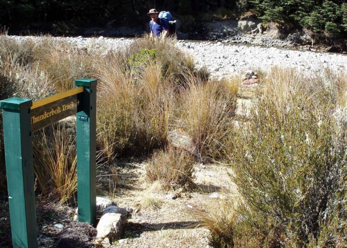
The track starts climbing immediately up Urchin but the grade isn’t too bad. Just over an hour up the track the grade eases. A good campsite is on a little sidetrack to the left. There is a small spring in the bush a short way where water can be obtained.
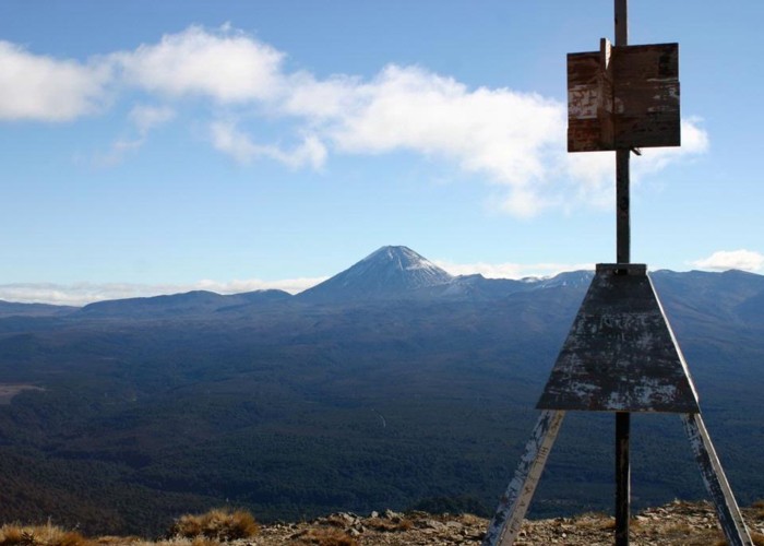
After the campsite the grade soon steepens and climbs to bush line and soon after the Urchin Trig is reached. Enjoy the good views of Tongariro National Park and Lake Taupo from here.
The track travels up and down for about 30 mins along a ridge following poles and soon the river flats of the Waipakihi can be seen ahead. The track then drops steeply to the river.
There is a popular camping spot where the track reaches the valley but there are many others scattered all around the area.
There is no track up the river. Just follow your nose and cross the river where necessary. Don’t dream of keeping your feet dry, you have to cross the river often. Some people find this section of the trip quite hard and the river seems to keep going for a long time. It can also be cold going in the winter. Eventually the hut is seen ahead of you.
Waipakihi Hut is a comfortable hut and has a good stove with a good supply of coal. The secret to the fire is to close the door after you have lit it. It draws better with the door closed.
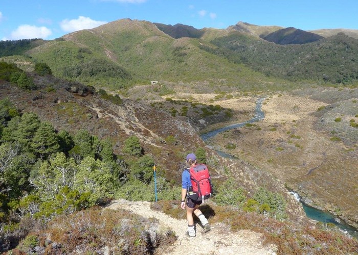
The return journey across Umukarikari goes up a ridge below and straight in front of the hut. It climbs until above bush and scrub before the grade eases and gently climbs along the open ridge for the summit of Umukarikari. The track is marked with poles but often many of them have been blown over. This is an exposed route and would require care in poor weather and bad visibility.
The track sidles below the top of Umukarikari and Sharp Cone and drops down a little gully before a long descent down the other side. There is a little climb, which takes you by surprise at one point as the track climbs onto another little ridge system before dropping to bush line. There is a camp site to the left of the track about 10 mins before you get to bush line and water can be obtained from the stream that you can hear below.
Once in the bush it is an easy couple of hours on a good track to arrive at the car park at the bottom.