Waitakere Dam, tunnels and Anawhata Stream Loop
- 4 hr 30 min – 6 hr loop track with a road section
- Easy
Waitakere Dam, tunnels and Anawhata Stream Loop
This 4.5 hour walk takes you through kauri forest, ferny-edged streams, up and along ridges with fantastic views and past spots of interest to engineery types (water supply) and history buffs (kauri felling).
10 members favourited
3 members checked in
|
Walking time
|
0 – 1 day
4 hr 30 min – 6 hr
|
|---|---|
|
Distance
|
18.0km |
|
Type
|
Loop track with a road section
|
|
Grade
|
Easy |
|
Bookings
|
No bookings — open access
No — open access
|
|
Starts
|
Scenic Drive - Waitakere Dam carpark |
|---|---|
|
Maps
|
NZTopo50-BA31
|
|
Altitude
|
190m
–
300m
Altitude change 110m
|
The loop combines a number of tracks, starting from and ending at the Waitakere Dam carpark on Scenic Drive. The direction described here starts with the eastern side (because I wanted to find peripatus! ...Nope not this time).
Scenic Drive Dam carpark – Filter Track – Swanson Pipeline – Peripatus Track – (cross Scenic Drive) – Anderson – Waitakere Tramline Walk – Fenceline – RGB - Chateau Mosquito- Simla – Fenceline – Waitakere Dam Walk (road) – carpark.
Note that the track times on the signs are on the family-friendly side. At my average pace the tracks took about half the advertised time.
Also, in this area a local community group – ARK in the Park – is running trapping lines for stoats, possums, you name it. I saw the unusual sight of a tiny skink hatchling – you can quite possibly see hihi (stitchbirds) or NZ robins so keep a look out.
Eastern section (about 1h10m, 3.5km):
From the Dam carpark, head down the road to the Filter Track. Walk down a ridge of kauri to the Filter Station (in 20 mins) where some of Auckland’s drinking water gets processed. There are toilets opposite the station. Past that, the Swanson Pipeline Track takes you through a cool tunnel to the Peripatus Track. Cross the stream then head up. And up. About 40 mins to the top.
Western section (at least 3h20m, 14km):
Scenic Drive to Simla junction (1h):
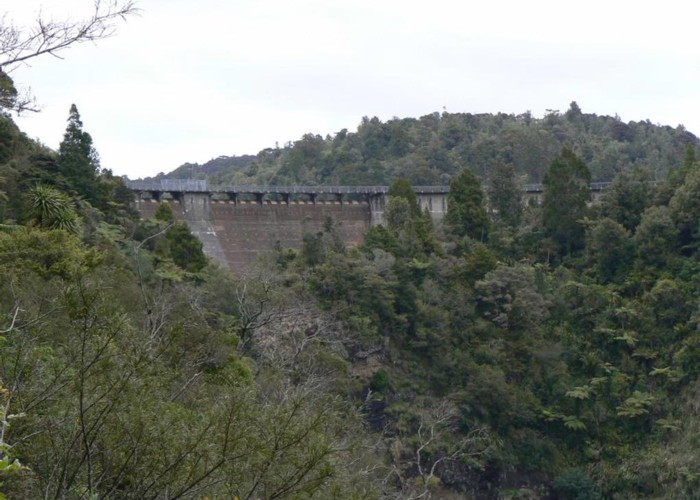
Pop over the road from Peripatus Track onto Anderson Track. At the next main junction head left to the Tramline Walk – from here to the Dam is about 30 mins with some fantastic viewing spots – just dodge the odd tram! Across the Dam is the Fenceline Track – head for the Simla junction.
RGB - Chateau Mosquito- Simla Loop (1h):
Turn left at Simla junction; after 5 mins is the Simla Track start, and after another 10 is the R.G.B track. The loop covers both of these so take your pick of which first. There are some pretty swimming spots in each: R.G.B when it hits the Anawhata Stream (a little shallow but worth the dip!), and in the same stream where it is straddled by the Simla Track.
Returning- Fenceline to Scenic Drive (1h20):
Head back along Fenceline Track, past the Dam and take the road up to Scenic Drive. There is a short (2 min) side walk to a huge kauri tree along the way.
ID 2740
About this track
Added 10 March 2008 by CarenCaren.
No revisions.
62 views in the past year (5 per month).