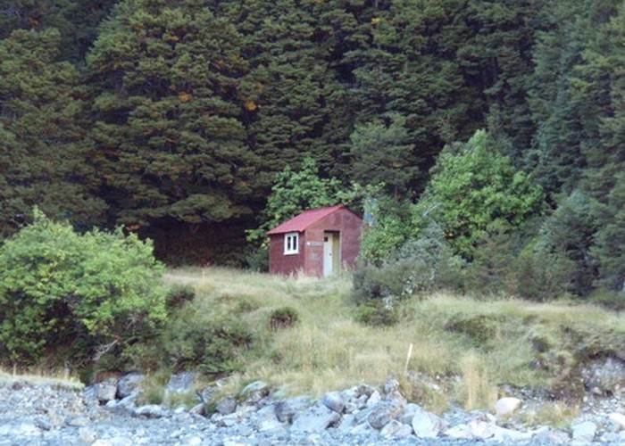
Waterfall Hut (Dobson Valley, Canterbury)
Ruataniwha Conservation Park
Waterfall hut has washed away.
Waterfall Hut (4 bunks, matresses, fireplace, firewood available, stream water) was a forestry-style hut tucked into a narrow side-valley off the Dobson. It takes its name from the waterfall behind the hut, descending from the Ben Ohau Range. Since leaving Readon Hut, the nature of the Dobson has changed: the glaciers are left behind, and the valleysides are beech lower down, with tussock and rock on the tops. The valley floor is wide and braided, with grazed tussock flats opposite the hut.
Hunting seems to be the main reason for visiting the hut. Trampers staying here are generally heading out of the Dobson by 3 alpine routes:
- Tragedy Col, directly opposite the hut into the Hopkins and Erceg Hut
- Jamieson Saddle, in the upper Dobson, to the Tasman/SH80
- Barron Saddle, onto the Mueller Glacier & Barron / Mueller Huts
- Route above the hut to Bushy St
|
Owner
|
Owner: DOC |
|---|---|
|
Category
|
Derelict hut |
|
Sleeps
|
Sleeps 4
4
|
|
Facilities
|
Toilet |
|
Water supply
|
Natural water source |
|
Getting there
|
Glen Lyon Stn.: 4WD river flats route. Hut -> Kennedy Hut (5.5km,1.5-3hrs) -> Grough Hut (6.5km,1.5-3hrs) -> Le Crens Hut (10km,2.5-5hrs) -> roadend (7.5km) My Cook Village via Jamieson Saddle: unmarked 2187m alpine route over rock/scree. Hut -> Readon Hut (4km,1-2hrs) -> Birch Hill (SH80) (13.5km, 5.5-11hrs). Mt cook Village 8km by road from Birch Hill. |
|---|---|
|
Unlocked
|
This hut is unlocked and open to access. |
|
Bookings
|
No bookings — open access
No — open access
|
|
Altitude
|
810m |
|---|---|
|
Mobile phone coverage
|
No coverage |
|
Maps
|
NZTopo50-BY15
|