We've been wanting to do this walk for some time, firstly because it is the highest point in the Kaimai-Mamaku range, at 952m asl, and secondly because we wanted to do a challenging walk in order to train for our planned 3-day tramp in the Whirinaki Forest Park over Waitangi weekend.
The weather forecast was for 26 deg. C, with cloud forming in the afternoon, and little or no wind, in other words, perfect. We left home at 6am, and were on the track by 8.10am. Finding the track proper was a bit of a challenge - there are numerous short walks and tracks in the area, many not signposted - more about this later. A local walker kindly pointed us in the right direction.
Well, from looking at the maps and reading the available literature, we learned that Te Aroha is pretty well straight up, and in this they weren't wrong! The heart rate was soon up to 140 plus, and pretty much stayed at that level all the way to the top. About 45 minutes after setting off, we reached the Whakapipi lookout, with a delightful view over Te Aroha/Waihou, and the Waikato plains in the distance. There are not that many opportunities for good views after this until you get near the top, as most of the walk is in forest or bush. The rest of the climb to the top was uneventful, and to be honest, I did not take that much note of the surrounding vegetation, my focus being on trying to supply my legs with as much oxygen as possible. The track was in excellent condition, well formed in most places, and the steep bits were often made easier by steps made from half round pole sections, covered with mesh.
About 20 minutes before the top we caught out first glimpse of the transmission tower on the summit through a break in the forest canopy - it seemed a lot closer than it actually was, and there always seemed to be another set of steps to climb, but eventually the track emerged onto the tar-sealed road just below the tower and the building housing the supporting machinery and equipment. Although this spoilt the experience somewhat, it is pretty impressive as engineering works go, and one has to admire the planning and logistics that went into building such a large structure in such an exposed and isolated spot. To get to the summit proper, we had to follow the road for about 50 metres around the building to the other side, where the trig is situated on a small hillock. A track to the left of this hillock leads one to the summit, and a well-deserved rest at the base of the trig beacon. Walking time to the summit: approx. 2 hours and 15 minutes.
The views absolutely took my breath away, and this alone was well worth the climb. To the east/north-east we could see Paeroa and Waihi towns, and in the distance, the sea near Waihi Beach, and even as far as Tauranga. To the south, the rest of the Kaimai-Mamaku range. As there was some light cloud building up over the Waikato plains, we were unable to see much to the west and north-west, but suffice it to say that one enjoys an unparalleled 360 degree view from the summit.
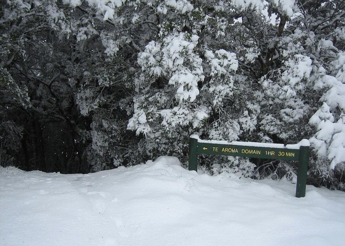
After having a drink of water, an apple, and a pleasant conversation with another tramper, it was time to move on. We walked about 30 metres back down the road, and turned left down the track signposted "Dog Kennel Flat". After having another short chat with two gentlemen on their way up this track, we continued on our descent. This track was a bit overgrown in places, but not difficult to follow. After about 30 minutes we reached Dog Kennel Flat, which turned out to be nothing more than a large levelled clearing next to the road leading to the summit, and containing a few stacks of timber and other material. About 5 minutes later we reached the intersection with the Waiorongomai Saddle track, and 30 minutes after that, the intersection with the Mangakino Pack Track. The track from here was fairly wide and easy, but hot, and there wasn't much cover for a while. Shortly after re-entering the forest we stopped for lunch and a cuppa, and to rest the somewhat wobbly legs. About 20 minutes after recommencing our walk, we came upon the old Tui mine, which was quite a (sad) sight to behold. The huge mine dump of crushed rock and tailings was bare of any vegetation, which is apparently due to the high concentration of heavy metals and acids. The stream that flows through the site is also not fit for drinking from, or even boiling for tea, being contaminated with said heavy metals, etc. This site provides ample evidence of the devastation caused by indiscriminate mining and processing of ore.
From the mine site the track follows a gravel road for some distance, before re-entering bush on the left of the road about a kilometre further on. Again the track from here on was well-formed and benched, and easy to follow. About half an hour down this track (passing the junction with the short track to Tui Road on your right) there was a sidetrack to the left, to a waterfall view. This was interesting, but not spectacular, understandably so in view of the dry weather. From this point it took us another hour and a half back to the start, through pleasant and cool forest, and occasional open patches. About twenty minutes before the end we hit some of the confusing side tracks mentioned earlier - just stay on the track ahead. At one point you arrive at a stile on the side of a gravel road - cross over the road, and re-enter the track through the stile at the other side. A short while later we arrived at yet another road - cross over this one too. Almost immediately Te Aroha's water treatment plant and reservoir appears on the left. From here, follow a gravel road which heads off to the right - this ends up at the top of Kotuku Street, and from here it was a short walk back to the car.
In conclusion, a walk well worth doing, but don't even think of it unless you are reasonably fit - it is hard going in places, and quite tiring. The summit views are amazing, and the mine workings interesting - worth a short stop to inspect. Heed the warning signs at the mine tunnel entrance though! Also take plenty of water - there is none to speak of on the way up, and we were not going to risk drinking water from the several streams crossed on the way down, in view of the many mine sites on that side of the mountain.
How to get there - from Auckland, either SH2 via Paeroa, or via route 26 from Morrinsville. From Paeroa, continue through Te Aroha, passing the clock tower on your left. If coming from Morrinsville, turn right at the clock tower. Then first left (after the clock tower) into Boundary road. There are parks a little way up on both the left and the right, opposite an Asian B&B. The start of the track is up a short drive on the right, just inside the gates to the domain and museum (signposted). Look for a small sign (on the right) pointing the way (to the left) to the geyser - take this track, and from the geyser the track to Whakapipi and the summit is well signposted. After our walk, we looked for a café to replenish our caffeine and fluid levels, and found a great one opposite the clock tower named "Ironique" - great place for an excellent flat white or latte, or an ice cold frosty to restore some of those lost fluids! Of course one can also treat one's weary bones to a soak in the spas, right where the track starts. Total time spent on the track was 7 hours, 10 minutes, stops included. Take time to drink in the views from the summit - don't rush it - food for the soul!
Further reading: DOC pamphlet "Te Aroha and Waiorongomai Walks", DOC park map "Kaimai-Mamaku Forest Park" and "Day Walks of Waikato & King Country" by Sonia Frimmel (Reed Publishing).
Mt Te Aroha summit and mine circuit
Ascending Mt Te Aroha from the domain, followed by a descent via the old Tui mine works.
Comments
-
kolsen Hi Dan. Have you done the track from Waitawheta Hut back in a westerly to Te Aroha via the summit? I understand the track is really overgrown. Do you know anyone who can tell us what it's currently like - and the timings.
Thanks.
KO
30 December 2005
-
neiljay Very useful, thanks. Just the sort of info I needed. I think I might wait and plan a while longer before doing this particular walk.
11 September 2004
-
tramp Thanks for a well ballanced article, it has helped me make up my mind about when I might like to do this walk.
Jo
25 February 2004
ID 175
About this article
36 views in the past year (3 per month).