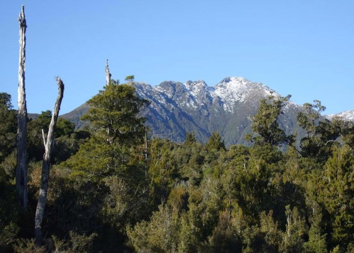
Mt Turiwhate July 2012

This pic was taken from Kawhaka Creek and looks east toward the summit of Turiwhate. (1373m)
Various creeks provide access up to the Turiwhate tops. Old tracks exist on ridges either side of Grahams Creek. This creek drains the northern side of the mountain into the Taramakau River and is named at its bridge on SH73. The easiest though not the most direct of the two routes is the one up the ridge on the TL of Grahams Creek. It starts 500m up the creek above the bridge & is maintained by Permolat Group volunteers. Allow a day to get up to the summit & back down again. A circuit involving both routes & a traverse across the tops is possible in a day. Be warned there is a bit of a scrub bash above the taller bush when using the TR route. It has not been cut for decades except for the lower portion used by possumers.
On one summit there is a trig plus the iron framework from a predecessor. NW of the trig below the ridgeline is a memorial to two plane crash victims from 1933.
Comments
-
 glennj The first 500m up Grahams Creek now has cut & taped sections where it's inconvenient to be in the creek. This starts from the Highway on the TR just above the road bridge.
5 April 2014
 -
 glennj I've remarked the start of the TL Grahams Creek track up to the tops to make it easy for people to find. It starts approx 500 metres above the bridge crossing SH73. Head up the bouldery creek for about 15 minutes until you see a couple of cairns. The track heads up a face perpendicular to the creek here. There is fresh red cruise tape marking the way up the face and on to the leading ridge that heads for the tops. The co-ords of the track start from the creek are NZTM2000 E1460620, N5266348
NB The upper section of the track is currently overgrown in a few places but is followable!
22 August 2012
 -
 glennj I took the photo whilst checking out the progress of one of the new cycleway projects. A section of the cycleway will link the "Old Christchurch Road" with the "Hydro Road extension of Milltown Road" about 1.5km from the Mt Kerr track start.
The cycleway is being constructed to a standard like a metal road & is good enough for cars where I went. If they don't block the completed cycleway to cars it would be a big shortcut for Canterbury people driving to the Mt Kerr or Arahura River track starts. Even if the completed cycleway is blocked to cars it will offer possibilities for combo mountain biking & tramping trips.
27 July 2012