Top Timaru Hut
Hāwea Conservation Park
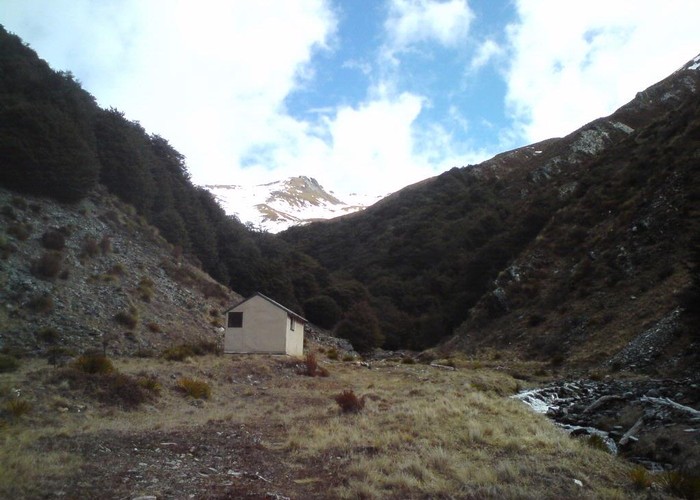
Sometimes just called Timaru Hut - this hut sits surrounded by tussock and rock upstream of the last forested section of Timaru Creek. The hut has 4 bunks, creek water, but no toilet. There's a wood store and an axe, but no fire either. The side-creek behind the hut is forested in beech, so firewood is also plentiful.
The area has been farmed in the past, and 4wd tracks run from the Ahuriri and Lindis Pass to the hut. The Ahuriri track forms part of the Te Araroa walkway. Below the hut, the Timaru River track leads to Lake Hawea, with options to climb to Stodys and Pakituhi Huts on the ridge to the south, or continue the full 25km down the river via the private but widely used Junction Hut.
Other local options include an easy 1600m pass behind the hut over to Mae West Hut on the south valley-side of the Dingle Burn. A high-level (i.e. alpine) route also runs west from this pass to Chamois Creek and Moonlight & Roses Hut.
|
Owner
|
Owner: DOC |
|---|---|
|
Category
|
Basic Hut/Bivvy |
|
Sleeps
|
Sleeps 4
4
|
|
Facilities
|
None |
|
Water supply
|
Tap or tank water |
|
Getting there
|
Ahuriri: 26km, 4wd track via (private) Tin Hut Lake Hawea (Timaru Creek Bridge): -> Junction Hut 20km, 4-9hrs -> Road 5km, 1-2hrs. Sidle track with valley floor sections. Many creek crossings Lake Hawea (Pakituhi track): -> Track junction 15km, 3-7hrs -> Stodys Hut 1.5km, 1-2hrs, 600m climb -> Pakituhi Hut 13km, 2-4hrs 4wd trk -> road 4km, 1000m descent, 1-3hrs Mae West Hut: 5km, 2-4hrs. Route climbs valley behind hut. Follows fence from bushedge to 1600m pass. |
|---|---|
|
Unlocked
|
This hut is unlocked and open to access. |
|
Bookings
|
No bookings — open access
No — open access
|
|
Altitude
|
900m |
|---|---|
|
Mobile phone coverage
|
No coverage |
|
Maps
|
NZTopo50-CA13
|