Islands Hut
Eyre Mountains/Taka Rā Haka Conservation Park
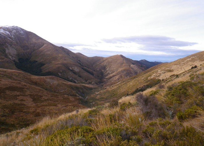
A 4 bunk hut in the upper tussock-and-beech reaches of a tributary of the Windley in the Eyre Mountains. River water, open fire, and plenty of dry wood around. The valley at this stage is a mixture of low scrub and tussock with islands of beech in sheltered spots. Immediately north of the hut the low 1400m tussock ridges rise to over 1700m, becoming steep and rocky and climbing to the main peaks of the southern Eyre Mountain range: Helen Peaks, and later Jane Peak.
One of the main attractions of Islands hut is it's remoteness - for many years not reached by any cut or marked track. Around 4-5 parties a year visit, probably for this reason. A route has now been marked downriver and over the ridge to Acton Stream - see the Doc Eyre Mountains brochure for details. Other unmarked routes cross low 1400m ridges to Cromel Branch and Upper Windley Huts. A higher route over the 1630m peak north of the hut to Upper Cromel also gets occasional use.
|
Owner
|
Owner: DOC |
|---|---|
|
Category
|
Basic Hut/Bivvy |
|
Sleeps
|
Sleeps 4
4
|
|
Facilities
|
Open fireplace |
|
Water supply
|
Tap or tank water |
|
Getting there
|
Acton Roadend: 10km - Marked route along ridge between Islands and Acton Stream - see Doc brochure for details Upper Windley Hut: 4.5km, 2.5-5 hrs- unmarked route. Valley floors very thick with scrub so best route sidles north valley side to pass, then sidles above the bushedge crossing 2 side streams and dropping from ridge opposite Upper Windley Hut Upper Cromel Hut: 7km Good but steep unmarked route over pt 1630 north of Islands Hut |
|---|---|
|
Unlocked
|
This hut is unlocked and open to access. |
|
Bookings
|
No bookings — open access
No — open access
|
|
Altitude
|
900m |
|---|---|
|
Mobile phone coverage
|
No coverage |
|
Maps
|
NZTopo50-CD10
|