Taurawharona Hut
Te Urewera
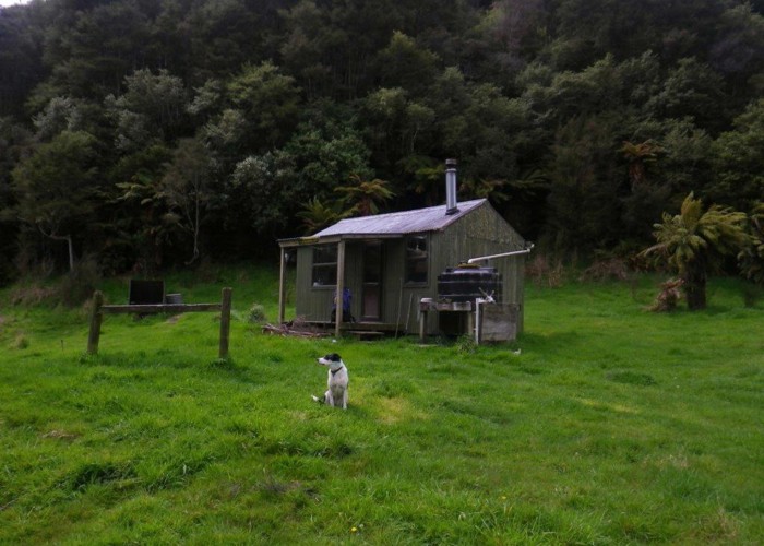
Situated in a football-pitch sized paddock above the Waikare River, Taurawharona is a typical Urewera hut. In reasonable condition, but full of the usual political / racial / anti-DOC abuse that goes with this area.
The N-S track between Tawhana and Maungapohatu is well maintained and well used. Traffic on this accounts for the majority of the users of the hut, much of them on horseback. The river crossing just north of the hut is knee-thigh-deep in normal flows, and could be tricky after heavy rain.
A track, not marked on maps, drops from the NW end of the paddock to the Waikare River, for those heading downstream to Otanetea. Modern DOC triangles then mark a route down the riverbed (why mark it? In case we follow the wrong river?) but an older permolat track seems to side the TL for much of the route.
|
Owner
|
Owner: DOC |
|---|---|
|
Category
|
Standard Hut |
|
Sleeps
|
Sleeps 6
6
|
|
Facilities
|
None |
|
Water supply
|
No water |
|
Getting there
|
Muruapara-Napier Rd: 17km, Cut Marked Track. Tauranga Valley Roadend: 17km, cut, marked track. Via Te Panaaa Hut (7km), and Te Purewa Hut (+5km) Otanetea Hut: 6km, 2-4hrs, riverbed route / track. Track drops NW to river, then riverbed route downstream. Knee-thigh deep in normal flows, 30+ crossings. Or pick up old sidle-track (TL) / deer trails (TR) higher on the face to avoid the river. Makomako Hut: 7km, cut tracks, 1.5-3hrs via Paetawa Trk & 6 Ft Track. |
|---|---|
|
Unlocked
|
This hut is unlocked and open to access. |
|
Bookings
|
No bookings — open access
No — open access
|
|
Altitude
|
360m |
|---|---|
|
Mobile phone coverage
|
No coverage |
|
Maps
|
NZTopo50-BG40
|
|
Link
|
www.doc.govt.nz/p...http://www.doc.govt.nz/parks-and-recreation/places-to-stay/backcountry-huts-by-region/east-coast/te-urewera/taurawharona-hut/ |