Thomas River hut
This hut is situated on the TL of the Thomas River about 6km upstream from its confluence with the Haast River. The Thomas meets the Haast opposite the Highway at Thomas Bluff. Unless the Haast River is below normal flows it is not possible to ford to access the start of the route up the Thomas without swimming! [We used canoes. A commercial jet boat operation will drop & pick up parties at spots along the Haast river. From hut book entries we gathered that fishermen & hunters commonly helicopter in to the hut rather than walk]
Once across the Haast the route to the hut follows up the TL of the Thomas. In places the track is a bit overgrown especially lower down but is generally readily followable & heavily marked. It took us with day packs and stopping for a couple of short stops 3hrs to reach the hut from the Haast - Thomas confluence. Returning was 15 mins quicker largely due to skipping a section of overgrown track & boulder hopping instead.
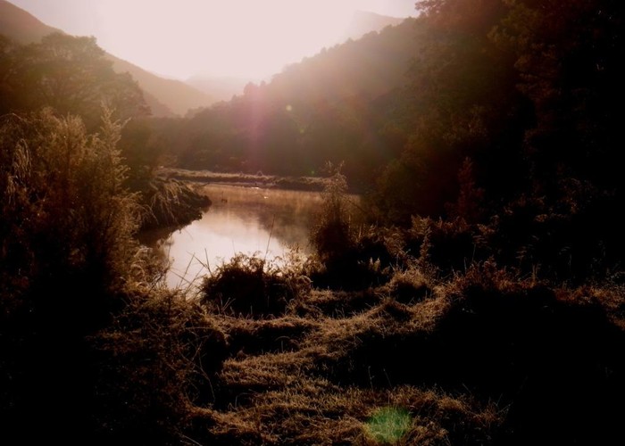
Nice river
|
Owner
|
Owner: DOC |
|---|---|
|
Category
|
Basic Hut/Bivvy |
|
Sleeps
|
Sleeps 6
6
|
|
Facilities
|
Toilet, Open fireplace |
|
Water supply
|
No water |
|
Getting there
|
The usual walk in route is to cross the Haast River to the confluence with the Thomas River & then follow up the TL of the Thomas approximately 6kms to the hut. DOC guideline walking time is 4hrs. |
|---|---|
|
Unlocked
|
This hut is unlocked and open to access. |
|
Bookings
|
No bookings — open access
No — open access
|
|
Altitude
|
162m |
|---|---|
|
Mobile phone coverage
|
No coverage |
|
Maps
|
NZTopo50-BY12
|