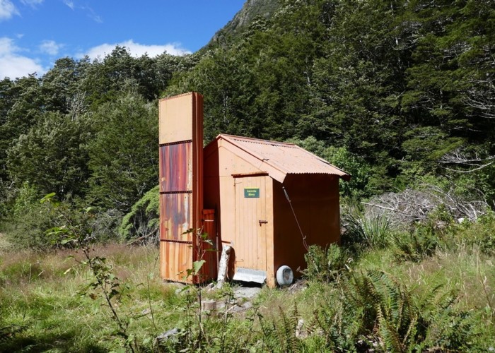
Lucretia Hut Route
- 3 hr 30 min – 4 hr 30 min return by the same track
- Easy/medium
Lucretia biv via Nina Valley
|
Walking time
|
1 day
3 hr 30 min – 4 hr 30 min
|
|---|---|
|
Distance
|
10.0km |
|
Type
|
Return by the same track
|
|
Grade
|
Easy/medium |
|
Bookings
|
No bookings — open access
No — open access
|
|
Starts
|
Lewis Pass highway - over the road from NZDA lodge |
|---|---|
|
Ends
|
Lucretia Biv |
|
Maps
|
NZTopo50-BT23
|
|
Altitude
|
640m
–
900m
Altitude change 260m
|
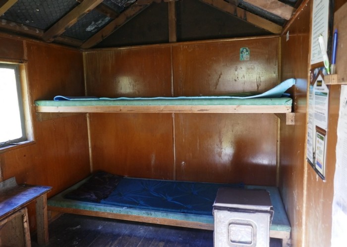
Follow the Nina valley track from the main highway up the true left of the river. The Nina/Lucretia junction is reached in about 2 hours (leisurely pace). From there the Lucretia track climbs above a gorge before descending back into the creek. One creek crossing required. The track is marked and easy to follow (Dec 2010) and takes anywhere between 1.5 to 2.5 hours to reach the biv (depending on fitness). The biv is in good condition, has got canvas bunks which can be an acquired taste. There are ample camping areas around the biv. For those who want to explore further there is a rough track marked with flagging that starts behind the biv which takes you to the head of the valley and it’s impressive cirque (approximately 1 + hours).
Alternatives for Lucretia biv include coming down from the Lucretia tarns, not having done it myself here is a friends e mail comments:
“Its not too bad dropping down from the tarns, even though it looks steep, you can pick your way down through the ledges. We did it when the face was frozen, and had to be careful, but even then, we didn't have any problems. As you get down the bottom, you want to negotiate the last terrace on the true left side of the creek, as there is a large bluff just above the bush line - you'll see it as you get down into the valley, there is actually a bit of an animal trail you can follow down one of the spurs and then into a gully to by-pass the bluff that spans most of the valley, but if you aim towards the true left after climbing down the ledges, you will be fine. When coming down, we found the best way was about halfway between the actual creek and its many waterfalls, and the face of the left hand side of the valley.
Its not easy travel by any means, but it is certainly do-able for average fitness, and no where that I remember was impossible or downright stupid to go, so long as you took the time to choose your route.”
Obviously this route does not fall into the easy/medium category.