Mt Hikurangi
- 1 – 2 days return via same track
- Medium
A classic trip up this sacred mountain, reputed to be the first place to see the sun on each new day
|
Walking time
|
1 – 2 days
12 hr – 20 hr
|
|---|---|
|
Distance
|
20.0km |
|
Type
|
Return via same track
|
|
Grade
|
Medium
1500m of height gain Grades explained
|
|
Bookings
|
No bookings — open access
No — open access
|
|
Starts
|
Pakihiora Station, Tapuaeroa Rd |
|---|---|
|
Maps
|
NZTopo50-BE44
|
|
Altitude
|
250m
–
1,752m
Altitude change 1,502m
|
This trip commences from the carpark at Pakihiroa Station. Drive across the bridge across the Tapuaeroa River and then up the hill until you see the DOC sign.
The carpark is at 250m above sea level and the hut is at 1200m so there is a bit of a climb. This is all done on farm tracks. You are allowed access here but do follow the yellow posts which mark the approved route. There are gates so please leave them as you found them.
After passing a plastic water tank the farm track ends and the final 100m to the hut climbs cruelly and more steeply over rough country. The hut should be reached by most people in 3-4 hours, not the 4-7 suggested on the sign at the bottom.
The track crosses a stile immediately behind the hut and climbs steeply up a grass covered scree for about 150m. It then becomes less steep and after 10mins in gnarled beech forest you come out onto alpine shrub-land. The track traverses pleasantly, passing a small tarn. It is well marked by white posts. If someone would like to edit these notes to describe the view, then please do so. There was only cloud when we were there.
The final 200m of the climb is a scramble up a steep gully. It is mostly stable but there are some loose rocks. Take care not to dislodge them and, if you do, shout to warn anyone below.
The route emerges onto the ridge between the two summits and a final traverse over some steep drops will lead you to the summit trig.
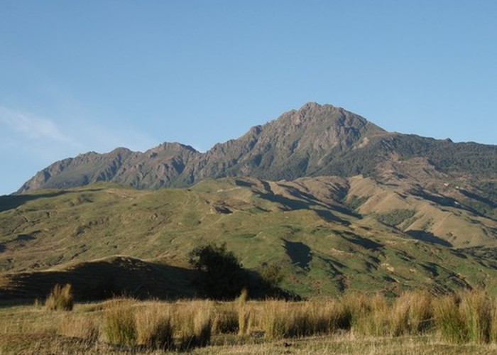
On a clear day there are fantastic 360 degree views of the Raukumara Ranges and the peaks of Whanakao, Taitai, Aorangi and Wharekia, and the sea on both sides of the Cape. Many people do a night climb to the summit in fine weather to be the 'first to see the sun.
On the way back you might want to detour to visit the carved statues of Maui Tikitiki-a-Taranga and his family. These are located about 100m below the hut and slightly to the east of the route that you came up.
ID 6152
About this track
64 views in the past year (5 per month).