Mistake Biv
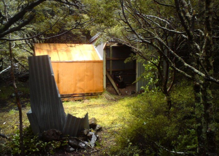
A dog-box biv above grassy flats in the upper Apias Creek, with a full height shelter tacked on. The biv sleeps two, and the shelter two more. Water is from the creek. There's a fireplace out the front. The shelter has a doorway at front and no door or floor. The biv itself is snug and weathertight, but some jerry-rigging will be required to keep the door closed as the catch is broken.
The hut lies on land handed over by DoC as part of a treaty settlement so is private. Mistake Biv and Aranga Hut have since had no maintenance. It is, however, 'still livable'.
The hut is about 50m above the forks, tucked away just beyond a small rock outcrop, in manuka scrub and easy to miss.
An old cut track up the opposite face downriver of the forks provides scrubby access to Aranga Hut and the main range. From the Aranga end this starts 100m downstream of the hut, and is hard to find. The ridge behind the biv leads to the bulldozed track to No Mans road.
|
Owner
|
Owner: PVT |
|---|---|
|
Category
|
Basic Hut/Bivvy |
|
Sleeps
|
Sleeps 4
4
|
|
Facilities
|
None |
|
Water supply
|
Tap or tank water |
|
Getting there
|
No Mans Road (balloted access): 4.5km, route / bulldozed track Aranga Hut: 3km, 1.5-3 hrs. Scrubby, very overgrown cullers track. Ikawetea Forks: -> Rockslide Biv (3km, 1-2hrs, river route) -> Ikawetea Forks Hut (7km, 1.5-3 hrs, river route / track). Look for triangle on left above 20m falls marking start of track Masters Shelter / Sentry Box: 3.5-7 hrs via Aranga Hut. Route then good track beyond hut. |
|---|---|
|
Unlocked
|
This hut is unlocked and open to access. |
|
Bookings
|
No bookings — open access
No — open access
|
|
Altitude
|
880m |
|---|---|
|
Mobile phone coverage
|
No coverage |
|
Maps
|
NZTopo50-BK37
|