Travers Peak - Trovatore - Henry Saddle
Lewis Pass National Reserve
- 2 days loop track
- Medium
- Deer Valley car park - Mount Travers: 2 hours 45 min
- Mount Travers - Trovatore: 2-2.5 hours
- Trovatore - unnamed creek under Henry Saddle: 2 hours
- Unnamed creek - Cannibal Gorge swing bridge: 1 hour 30 min
- Swing bridge - Lewis Pass: 30 min
- Rolleston Pack Track - Deer Valley: 45 min
An interesting circuit exploring the alpine tops around Lewis Pass.
|
Walking time
|
2 days
9 hr
|
|---|---|
|
Distance
|
16.5km |
|
Type
|
Loop track
|
|
Grade
|
Medium
Clear weather needed for tops navigation Grades explained
|
|
Bookings
|
No bookings — open access
No — open access
|
|
Starts
|
Deer Valley Camping Area, SH7 Lewis Pass |
|---|---|
|
Maps
|
NZTopo50-BT23
|
|
Altitude
|
800m
–
1,737m
Altitude change 937m
|
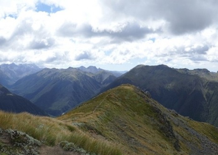
This is an excellent loop, spending much of its time on alpine tops with no route marking. If the weather closes in, a more realistic alternative may be to cross Boucher Saddle down to Anne Hut on the St James Track.
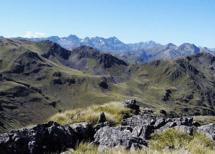
From Deer Valley, cross the road and take the Foleys Creek Track out onto tops and up to the summit of Mount Travers. Trovatore is the distinct peak to the north with a tall radio mast on the summit.
Drop off the steep northern flank to the ridge and follow the ridge north toward Trovatore. The ridge cuts across rock strata and is rather broken and lumpy, while tussock slopes either side of the ridge are steep and slippery. Either way, it's slow going. Eventually, the pretty basin beneath Trovatore is reached. The highest tarn is a good spot with beautiful views out to the east. A few minutes' climb to the ridge offers spectacular views down the Maruia River to the west and straight down to Cannibal Gorge.
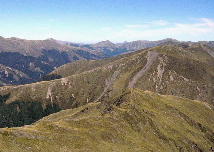
From Trovatore, follow the quick and easy ridge (with the strata this time) to the northeast past the tarn basin at the head of the Henry River and under peak 1724. Drop directly down to Henry Saddle over scree and tussock sprinkled with speargrass and Celmisia daisies. The saddle itself is cloaked in Dracophyllum and Hebe, flax, and tussock. Follow a gap in the trees toward the unnamed creek northwest of Henry Saddle. Travel through the beech forest itself is quick and easy.
Take the creek down to the junction with the Maruia River in Cannibal Gorge. (If you are walking in reverse, look for the wide shingle creek bed just after a bend in Cannibal Gorge and follow it upstream. Once you can see a prominent scree slope near the head of the valley, watch for a distinctive dip in the ridgeline on the true left: this is Henry Saddle. Climb up through beech forest to the saddle.)
From the Cannibal Gorge confluence, follow the riverbed down to the St James footbridge. It is easier to cross the river and climb up directly under the north side of the bridge, but it must be possible to bash your way along the southern bank. An easy forest stroll leads out to Lewis Pass (intentions book, toilet, rainwater supply), and the Rolleston Pack track sets off south along the road back to Deer Valley (toilet).
Walking times: