Hacket Circuit
Mount Richmond Forest Park
- 6 hr – 7 hr 30 min return via same track
- Easy/medium
A good day walk mainly along the Hacket Creek, including Hacket and Browning Huts. Dogs are allowed in the Mt Richmond Forest Park on a lead.
|
Walking time
|
1 – 2 days
6 hr – 7 hr 30 min
|
|---|---|
|
Distance
|
18.0km |
|
Type
|
Return via same track
|
|
Grade
|
Easy/medium
Multiple stream crossings - water low enough for stepping stones in summer Grades explained
|
|
Bookings
|
No bookings — open access
No — open access
|
|
Starts
|
Aniseed Valley carpark: drive over the hill into Aniseed Valley and follow the road some distance until "the end", just before it turns to gravel (on the outside of a bend) is a DoC sign and a carpark with toilets |
|---|---|
|
Ends
|
Aniseed Valley carpark, Richmond |
|
Maps
|
NZTopo50-BQ26
|
|
Altitude
|
450m |
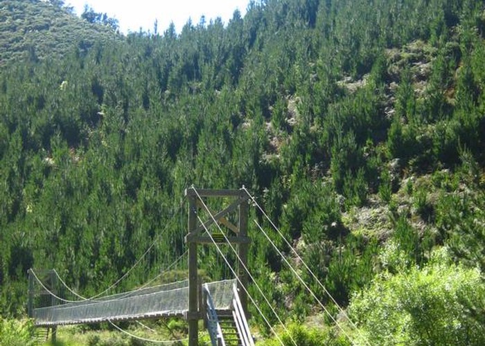
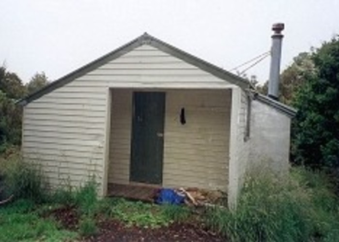
Follow the DoC signs from the car park and continue for the first 30mins - 1 hour over the swing bridge and by the river. Take the right fork towards Hacket Hut (the left fork is to Whispering Falls walk - is also beautiful) and later on the right fork again. Cross the river via stepping stones (when water is low) to Hacket Hut. Facing the hut, turn left and follow a small path which comes to another DoC signpost in about 2 mins (signpost not visible from hut). This directs you to Browning Hut, about 1 hour to 1 1/2 hours away. After about 15 mins another fork is reached, follow the signs and take the right hand. Browning Hut has a bench and is right next to the river for a nice stop. To return, retrace your steps but take the right hand path at the first fork you come to. At the next fork go right again and you have returned to the original path just before the Hacket Hut.
There is a 30 minute side path to an old mine between the Hacket Hut and the turn off for Whispering falls.
Popular with mountain bikers so just be aware.
There is a swing bridge to cross although the river may be forded instead slightly further up stream - feet will get wet with this option!
Dogs allowed on leads
This isn't very steep or reach very high elevations, it is just long