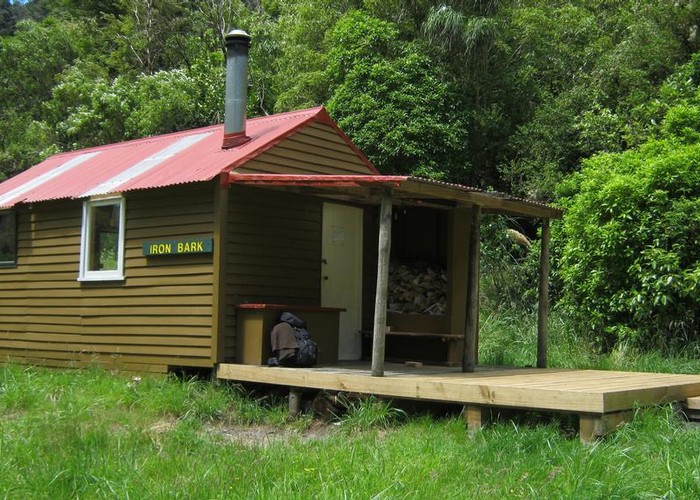
Iron Bark Hut
Ruahine Forest Park
Iron Bark Hut sits on the western bank of the Maropea River in the Ruahine Ranges. It's a standard 6-bunk forestry style hut with a Pioneer woodburning stove, and water from the creek. The surrounding bush is a mixture of scrubby lancewood, 5-finger, etc and finding something that burns can be a challenge.
On the floor of a deep valley, with ridges to the north, west and east, this hut received a total of 40 minutes of sun on the 19th of June - 2:00pm to 2:40pm. 40 minutes: that's your lot!
The hut book reports good fishing in the area, and there are numerous grassy slips on the valley-sides up and down river.
The track heading west to Mokai Station is private beyond the ridgeline above the hut. The more common access is via the poled route to Otukota Hut. The valley is navigable both up- and down-river in low to moderate conditions, but expect to get wet with deep pools.
|
Owner
|
Owner: DOC |
|---|---|
|
Category
|
Standard Hut |
|
Sleeps
|
Sleeps 6
6
|
|
Facilities
|
Toilet, Enclosed wood/coal burner |
|
Water supply
|
Tap or tank water |
|
Getting there
|
Mokai Station (via Otukota Hut): -> Otukota hut (4km)-> Mokai Station (9km, poled route) Otukota Hut (via river): 4km (2-4 hours). Riverbed route Otukota Hut (via track):7km (note: 1000m climb). Track Colenso Hut: 5km (2-4 hrs) track. Riverbed options also exist via Unknown Stream or Mangatera River Waikotere Biv: 9km (DOC say 8 hours). Track over Ohutu Ridge, or riverbed route up Waiokotere River |
|---|---|
|
Unlocked
|
This hut is unlocked and open to access. |
|
Bookings
|
No bookings — open access
No — open access
|
|
Altitude
|
520m |
|---|---|
|
Mobile phone coverage
|
No coverage |
|
Maps
|
NZTopo50-BK36
|