Mokoroa Stream Track
- 2 hr 15 min one way
- Easy/medium
A lush forest trail criss-crossing the Mokoroa Stream and leading to the foot of the Mokoroa Falls.
|
Walking time
|
2 hr 15 min |
|---|---|
|
Distance
|
5.0km |
|
Type
|
One way
|
|
Grade
|
Easy/medium |
|
Bookings
|
No bookings — open access
No — open access
|
|
Starts
|
Constable Road, south of Muriwai. |
|---|---|
|
Ends
|
Horseman Road, west of Waitakere. |
|
Maps
|
NZTopo50-BA30
|
|
Altitude
|
20m
–
180m
Altitude change 160m
|
While the Goldie Bush Walkway meanders through the dry hillside forest above, this track is confined to the stream edge. It is a much prettier route, although less suitable for younger families. The Stream Track combines well with the Falls and Goldies Bush Tracks to form an interesting circuit from either Constable Road or Horsemans Road. It is described here in combination with the Falls Track.
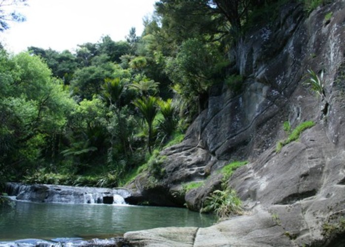
From Constable Road, drop down through young kauri forest to the stream edge. The Goldies Bush Track crosses the stream here, while the Stream Track turns upstream on the clay of the true right bank. The track winds through damp forest studdded with nikau palms, making regular stream crossings and edging around rocky outcrops. At intervals, some clambering is required along ledges well above the river.
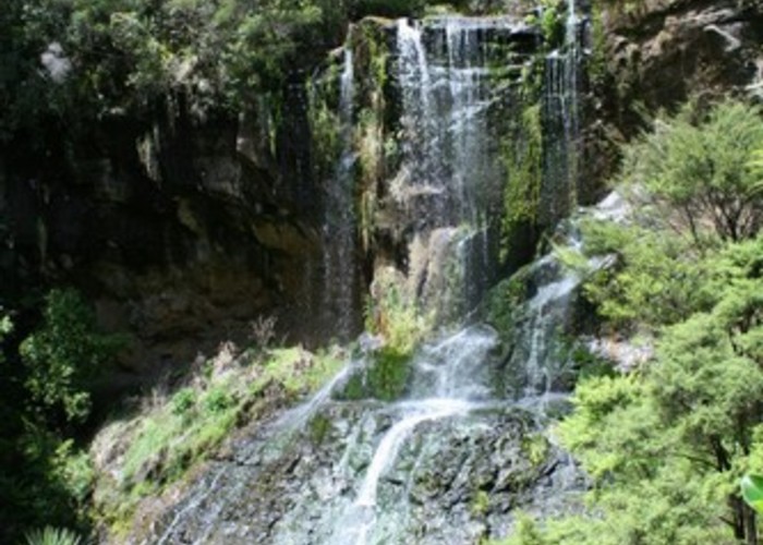
1 hour 45 minutes from the car park, the stream leads up to the amphitheatre formed by the Mokoroa Falls and the smaller Houheria Stream Falls. A track climbs the true left bank a few metres back along the stream, leading to an impressive lookout over the falls.
It's an easy stroll from here along the Falls track to the Horseman Road car park. The track leads through dry mixed kauri forest and passes the Goldie Bush turn-off just before the car park.