Cedar Flat
- 7 hr return via same track
- Easy/medium
An easy and pleasant walk into a secluded valley near Hokitika. Rudimentary hot pools.
|
Walking time
|
2 days
7 hr
|
|---|---|
|
Distance
|
15.0km |
|
Type
|
Return via same track
|
|
Grade
|
Easy/medium |
|
Bookings
|
No bookings — open access
No — open access
|
|
Starts
|
Side road off Upper Kokatahi Road south east of Hokitika. |
|---|---|
|
Maps
|
NZTopo50-BV19
|
|
Altitude
|
95m
–
520m
Altitude change 425m
|
The nearby hot springs are much discussed (and derided) in the hut book but are worth investigating. If you are looking for the premiere West Coast hot pool experience, however, you may want to try Welcome Flat. There are also decent chances of spotting blue duck in the vicinity. Watch for them in the mornings and evenings near the Toaroha swingbridge or feeding in the rapidly flowing side-creeks near the hut. Fantails are pleased to accompany trampers, the whoosh of New Zealand pigeons is notable overhead, and yellow-breasted tits, tui and bellbirds are also common. At the time of writing, the track beginning is a little hard to find, but the following instructions, accompanied by the map mentioned above, should prove adequate.
Access
From Hokitika the Kaniere Road leads inland north of the Hokitika River, coming to a junction at Kaniere. Turn right, following the signs to Kokatahi through farmland, and turn left onto Upper Kokatahi Road at another junction. Two kilometres after you cross the Styx River a gravelled side road leads off to the right. A small sign here indicates, "Kokatahi Valley Access." Over the Kokatahi River, the road continues for 1½km, deteriorating into a farm track. Beyond a series of gates the track turns and drops off the river terrace onto the flats below. The ground is wet and muddy, so most vehicles should park on the terrace, perhaps before the first of the gates. The vehicle track continues south beside the river for some distance, surmounting a small rise (ignore the track to the left here) and dropping closer to the river. Past the debris deposited by the commonly dry Papauma Creek the open flats eventually draw to an end. Orange triangular markers to the left lead onto the old tramway at the beginning of the track. It is 20 minutes walk here from the first of the gates.
Road End-Cedar Flat Huts: 3½ hr
Rails and sleepers are occasionally visible as the old logging tramway continues along a wide and gently climbing track. Other heavy pieces of equipment sometimes poke out from the undergrowth. Clear Creek is crossed after 10 minutes, and the track becomes light and boggy as it crosses a shallow slope beneath Sam Knob. At a small side-stream a signposted flood route veers off to the left, travelling along the cliff tops and avoiding the following riverbed section. Twenty minutes from Clear Creek the track drops quickly to the river, sidling downstream briefly before dropping onto the bouldery river-bed.
There is no track for the riverbed section. Keep to the true right bank, or return to the flood route if the river is high. The route clambers around boulders as 100m vertical cliffs come into view on the left. These soft cliffs are outwash gravels built up during past interglacials. Greenschist rocks here are often covered (and filled) with a profusion of long black hornblende needles, along with some red garnets. The river cuts under the cliffs, so it is necessary to wade for a few metres. Ahead, in the distance, a depression in the ridgeline marks the summit of the track, where it climbs to avoid the Toaroha Canyon section of river-bed. There are 50 minutes of riverbed travel to a major side-creek near some massive boulders.
The track begins again, strolling through bush to a small mossy river that has carved the path of a waterfall into the rock. Macmillan Creek is crossed after 15 minutes, and the track climbs out quickly to sidle next to a small, high-sided creek. A few small creeks are crossed until, less than 1 hour from Macmillan Creek, views of the precipitous gullies on the opposite flank of the valley appear through the trees. This is the upper stretch of the Toaroha Canyon. A gentle descent to a view across the flat takes 30 minutes. From here an avenue of horopito leads to 5 minutes of riverbed travel before the track takes up once again near a conspicuous totara. A few minutes' walk leads to a junction with a long swingbridge over the river on the right and the route to the hot pools beginning on the left.
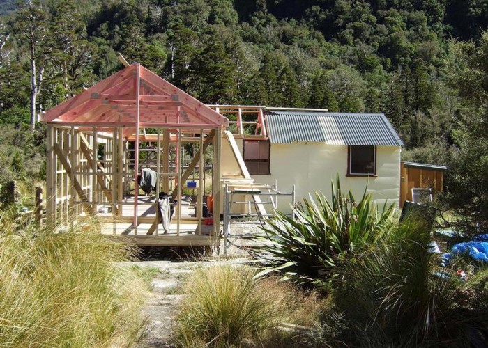
The huts sit in a field of tussocks on the flat across the river. The two huts are of a similar standard, and the old hut is quite spacious. Camping is possible nearby.
A track from the bridge turns left through the cedars where a sign indicates 5-6 hours to the Top Toaroha Hut. A trail through the tussocks leads down to the riverbed and the beginning of the Squall Peak Track. The New Zealand cedars (kaikawaka, Libocedrus bidwillii) are small but handsome trees with tapering, straight red trunks and sculpted triangular crowns. The frosty conditions of the flat encourage them to grow at this low altitude.
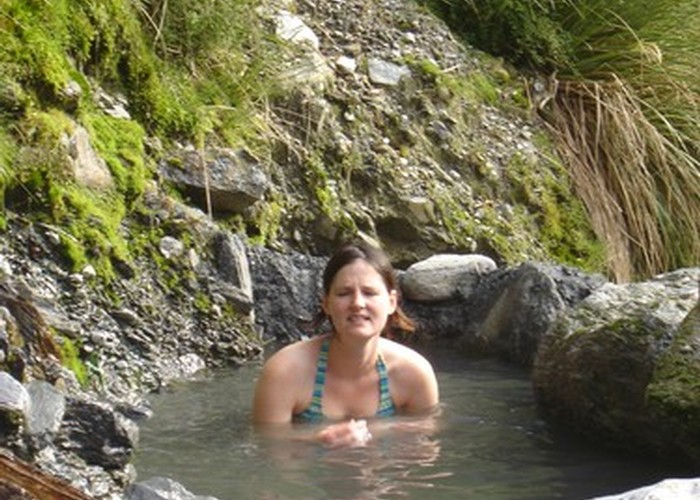
Wren Creek Hot Pools: 10 min each way
Check in the hut book for up to date information. Grab one of the shovels, cross the bridge and follow the rough, marked track. This soon drops down onto a grassy flat by Wren Creek, surrounded by mountain holly. It would be possible to camp here. Follow the sign down to the creekbed near a large cairned boulder. Look for a second cairned boulder a few metres upstream. A hot spring is located on the true left bank, opposite this boulder. If the pool has not already been dug out, dig at the top end of a small gravel cliff, just downstream of a dirt outcrop. The shingle and sand here cover the pool over whenever the creek floods. It is worthwhile to put some time into digging and building up a protective rampart against the waters of the creek before sampling the pool. Another hot pool farther upstream on the true right is generally considered to be not worth visiting (this is located near a third cairned rock).