Top Crawford Bivouac (Removed)
The Top Crawford Bivouac (2 bunks, no matresses, stream water 100m distant, no fire) is a typical alpine Biv, with one bed on the left wall, one on the far wall, and a cooking shelf on the right wall. A kero stove (but no kero) is supplied - it is unclear whether this works. The biv is well maintained, and appears rodent-proof - a welcome change!
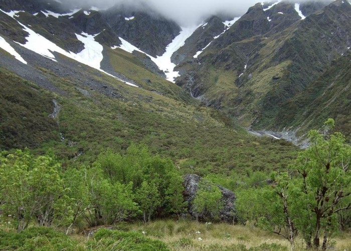
The biv lies on grassy flats in the upper Crawford Valley. It is about 700m upstream from the end of the cut, marked valley track, and on the opposite side of the river - a river crossing is necessary, but should be possible except after severe rainfall.
A steep poled route leads from the hut to the Styx Valley, via the beutiful, tarn-studded Lathrop Saddle and Browning Range Biv. Hanging valleys to the south of the hut, leading up to glaciers on Mt. Learmont also look worthwhile exploring.
|
Owner
|
Owner: DOC |
|---|---|
|
Category
|
Basic Hut/Bivvy |
|
Sleeps
|
Sleeps 2
2
|
|
Facilities
|
None |
|
Water supply
|
Tap or tank water |
|
Getting there
|
Styx Roadend (J33 596122): 20km - steep climb over a poled alpine route from biv to the Styx Valley, then a benched track to the roadend. Via Lathrop Saddle, Browning Range Biv (3.5km, 3-5hrs), Grassy Flats Hut (5.5km, 4-8 hrs) and Mid Styx Hut (9km) Kokatahi Roadend (J33 577110): 16.5km - poorly maintained cut/marked track down the valley to the road via Top Crawford Hut (2.5km, 1.5-2.5hrs), Crawford Junction Hut (6km, 3-5hrs) and Booboo Hut (12km) |
|---|---|
|
Unlocked
|
This hut is unlocked and open to access. |
|
Bookings
|
No bookings — open access
No — open access
|
|
Altitude
|
860m |
|---|---|
|
Mobile phone coverage
|
No coverage |
|
Maps
|
NZTopo50-BV19
|