This tramp is an ideal winter excursion, and safe under almost all weather conditions, as there are no river crossings to speak of (except several small streams). You will arrive at the hut with dry feet (if gaiters worn) with some energy to spare.
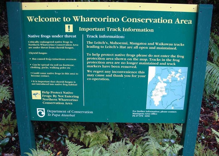
There are several access points to the Whareorino Forest, but the route described here is the quickest, and starts at the parking area at the end of Leitch Road. To get there, drive to Pio Pio on SH3 from either Hamilton or New Plymouth. Turn north into Kaka Road, then left into Mangaotaki road. Follow this for about 15 km (note the unusual limestone bluffs and outcrops along the way), and then turn left into Leitch road. About 2km further the road forks – Leitch road continues on the right fork for another 4 km, after which you reach the parking area up a slight incline on the left. The track start is at the far end of the parking area, to the right of the DOC sign.
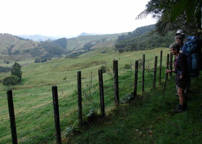
Almost immediately you’ll come to a gate – go through, remembering to close it behind you. The track then starts up a gentle incline, and meanders through regenerating bush. As the track more or less follows a farm fence for about 45 minutes, there are many glimpses of rolling paddocks through the trees, with some great views down the valley at one point. Just after this one rounds a corner, and the paddocks disappear, to be replaced by bush views.
About an hour from the start you’ll reach a saddle with a signposted track junction. The right fork/track has been closed (to protect endangered native frogs), and is now very overgrown. Take the left fork, and after climbing over a low hump, one almost immediately starts a gentle descent. This is great walking on a great track, and although there are some muddy patches, there’s not much else to worry about.
There are some lovely views across the valley at a few points – take time to appreciate them, as there’s no rush. Enjoy the bush as well, which mostly comprises tawa, kamahi, hinau and rewarewa – I also spotted a young totara, and further down on the grassy flats, some kahikatea. About 1 hour and 30 minutes after the junction you’ll suddenly see and hear the Awakino river through the trees on your right, and a few minutes later one abruptly emerges from the forest onto said grassy flats, at a gate and the dilapidated remains of a fence. The area was once farmed by Sam Leitch, who eventually abandoned it. There was a book in the hut detailing the history of the area, including Sam’s story – made interesting reading. From comments in another article, I believe this book has now dissappeared, which is a pity. It was in a rather delapidated condition, under a stack of magazines. I think one's trip is always enriched by learning about the history of the place visited.
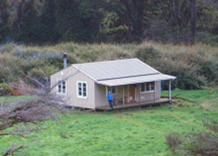
Just beyond the gate is another track junction and signpost – turn left, and follow the alternating yellow and orange track markers across the grassy flats and through patches of forest for about 20 minutes, after which the hut suddenly appears in view after rounding a large (now dead) macrocarpa.
The hut itself comprises a large common area with internal sink bench, water supply, large table and two bunkrooms with room for 16 (more, at a squeeze) persons. There is a very efficient wood/coal stove in the one corner with a wetback, which produces piping hot water after a few hours of lovingly tending the stove! Luxurious, to say the least. The hut quickly warms up to a super-cosy level – very comfortable.
As this hut is fairly popular with the locals and with tramping clubs, take a tent along, especially in summer. Plenty of good camping space is available around the hut, and if you like swimming or fishing, the Awakino river runs about 30 metres or so behind the hut. As there are feral goats in the area, hunters also make frequent use of the hut. There is plenty of birdlife around, and also look out for long-tailed bats at dusk.
Return to the start is the same way you came – there are alternatives, but DOC has requested that people not use certain tracks and parts of the forest and the Herangi range for fear of spreading the chytrid fungus, which has affected the endangered native frog species inhabiting the area. Also note that the alternative route from/to Gribbon road runs through private property, and is closed during the lambing season.
Total walking time from Leitch Road to the hut should be about 3 hours, and the same back. Applicable topomap is R17, Awakino.
Further reading:
Daywalks of Waikato & King Country – Sonia Frimmel (Reed Publishing)
North Island Weekend Tramps – Shaun Barnett (Craig Potton Publishing)
DOC pamphlet, “Whareorino and Tawerau Forests” Waikato Conservancy