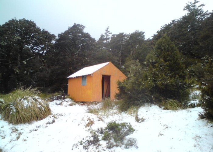
Aranga Hut (dilapidated)
The Aranga hut (4 beds, wood-burning stove, stream water) is located on the saddle at the head of the Makaroro valley, on the track from the No Mans Roadend to the main Ruahine Range on the west of the valley.
The hut is private, but open for public use. Sadly it appears to receive little maintenance,and is close top becoming uninhabitable. It was once (2006) a comfortable place to spend the night (compared to the nearby Kylie Biv, at least!). What it lacks in condition it makes up for in character: the beds appear to be made partially from old DOC track signs: possibly explaining tha lack of such outside!
The hut lies beside a small stream, in a clearing in beech forest adjacent to the track and is impossible to miss. It is indicated on map U21 (2005 edition) by black 'building' point, and not named or marked as a 'hut'.
|
Owner
|
Owner: PVT |
|---|---|
|
Category
|
Private hut |
|
Sleeps
|
Sleeps 4
4
|
|
Facilities
|
Enclosed wood/coal burner |
|
Water supply
|
Tap or tank water |
|
Getting there
|
No Mans Roadend (278990,617480): 10km (3-6 hours) cut, marked track and poled route Sentry Box roadend / Mangleton Road (279170,616550): 7km (time unknown) track Kylie Bivouac: 10km (3-6 hours) partially poled route Parks Peak Hut: 7km (time unknown) track Mistake Biv: 3km, route. Rough track starts on right 100m down the small creek beside Aranga, climbs to ridgeline and follows ridge to bushedge. Route N along ridge & drop spur opposite the biv. |
|---|---|
|
Unlocked
|
This hut is unlocked and open to access. |
|
Bookings
|
No bookings — open access
No — open access
|
|
Altitude
|
1,340m |
|---|---|
|
Mobile phone coverage
|
No coverage |
|
Maps
|
NZTopo50-BK37
|